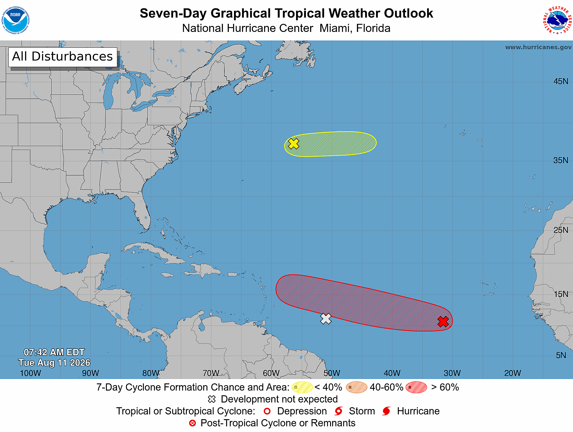
The U.S. National Hurricane Center’s 8 a.m. Tuesday advisory has highlighted growing concern over a tropical disturbance moving across the central Atlantic, which meteorologists say carries a substantial probability of strengthening into a full tropical cyclone before the end of the week.
At the time of the update, the disturbance was positioned roughly 500 miles southwest of the Cabo Verde Islands, off the western coast of Africa. Right now, the system only generates scattered, limited shower activity and thunderstorms, a sign that it has not yet begun the process of organized strengthening.
Despite its current disorganized state, forecast models point to increasingly supportive atmospheric and oceanic conditions over the next 48 hours that will help the system consolidate. Meteorologists project that a tropical depression — the first organized stage of a tropical cyclone — will likely emerge by the second half of the week as the disturbance follows a slow westward to west-northwestward track across the open central tropical Atlantic.
Probability data released with the advisory puts the odds of cyclone formation within the next two days at 30%, while the seven-day formation chance climbs significantly to 70%. Beyond this primary disturbance, forecasters are keeping a close watch on a second area of unsettled weather in the subtropical Atlantic. For that second system, forecasters say a short-lived weak cyclonic development could occur over the next 24 to 48 hours as they continue updating model projections.