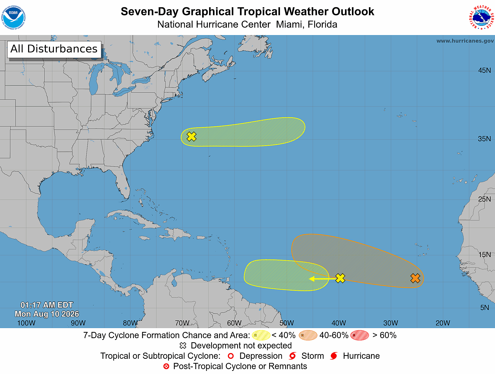
The United States National Hurricane Center (NHC) has raised the probability that a budding weather system in the eastern and central tropical Atlantic will strengthen into a tropical cyclone over the coming week, updating the likelihood to 60% in its latest official outlook.
In the 2 a.m. update released Monday, forecasters noted that the disturbance, a small low-pressure zone positioned hundreds of miles south of the Cabo Verde Islands, is currently producing scattered, unorganized showers and thunderstorm activity across the region. The system is currently progressing westward at a slow pace, and meteorologists project it will combine over the next few days with a tropical wave that is currently sitting over the West African mainland.
Conditions across the Atlantic are forecast to become increasingly conducive to cyclone development by the middle of this week, forecasters added. By the second half of the week, as the combined system tracks westward to west-northwestward across the central tropical Atlantic, a tropical depression could form from the disturbance.
The updated odds mark a noticeable increase from the NHC’s previous outlook issued Sunday night. At that time, the agency put the 48-hour formation chance at 10% and the seven-day probability at 50%; those figures now sit at 20% and 60% respectively.
This active disturbance is not the only weather system being tracked across the Atlantic basin this week. A second tropical wave, located roughly halfway between West Africa and the Lesser Antilles, holds a 20% chance of development over seven days. While the system could see slow, gradual strengthening as it moves westward at a fast clip, upper-level atmospheric winds are expected to grow less favorable for development as the wave nears the Lesser Antilles later this week.
Forecasters are also monitoring a third system: a trough of low pressure located west-northwest of Bermuda. This disturbance carries just a 10% chance of development over the next seven days as it tracks eastward across the western and central subtropical Atlantic. Its odds of strengthening are projected to drop to zero after Wednesday, however, as the system moves into cooler ocean waters that cannot support tropical cyclone development.