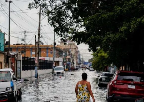
As the weekend approaches, the Dominican Republic is bracing for a stretch of oppressive heat paired with erratic weather patterns driven by tropical systems and atmospheric activity, according to official weather forecasts. The unseasonably warm conditions kicked off on Friday, with most areas starting the day under bright, mostly clear skies that quickly gave way to building cloud cover through the afternoon and early evening. Forecasters have warned of isolated showers and thunderstorms expected to form across a swath of inland and coastal provinces, including Monte Plata, San Cristóbal, San Pedro de Macorís, San José de Ocoa, Monseñor Nouel, Samaná, Azua, San Juan, Elías Piña, and multiple districts of Greater Santo Domingo.
Across the majority of the country, daily high temperatures are projected to climb into a sweltering range between 33°C and 35°C, while overnight lows will stay mild, hovering between 23°C and 25°C – keeping overnight conditions uncomfortable even after sunset.
Moving into Saturday, the first of two scheduled tropical waves will trigger scattered morning showers along the island nation’s northeast and southeast coastlines. But a counteracting air mass carrying elevated concentrations of Saharan dust will work to suppress atmospheric moisture and cut down on potential rainfall across most inland areas. As a result, only limited scattered showers and isolated thunderstorms are forecast for Saturday, concentrated in Monte Plata, Monseñor Nouel, San Cristóbal, Sánchez Ramírez, La Vega, San Juan, and sections of northern Santo Domingo.
Sunday will bring a second, more active tropical wave, which when combined with elevated humidity levels and a deep upper-level trough, will produce more widespread precipitation. Forecasters are calling for scattered, locally moderate to heavy downpours across large portions of the country, paired with thunderstorms and sudden gusty winds. The worst of these conditions are expected to impact southeastern provinces – including the heavily populated Greater Santo Domingo area – as well as the northeast coast, the Central Mountain Range, and the country’s western border region, with peak activity forecast for the afternoon and evening hours.
Public health and safety officials have issued a series of guidance to help residents cope with the dangerous heat. They advise all residents to maintain steady hydration, avoid extended periods of direct sun exposure between the peak heating hours of 11:00 a.m. and 4:00 p.m., and wear loose, light-colored lightweight clothing to help regulate body temperature. Extra precautions are urged for vulnerable groups including young children, pregnant people, elderly residents, and individuals living with chronic underlying health conditions, who face higher risk of heat-related illness.
Additional hazards are forecast for coastal areas: starting Saturday, the Dominican Republic’s Caribbean coast will see increasingly rough surf conditions, with the most severe conditions expected along the shoreline from Pedernales to Barahona.