As the 2026 Atlantic hurricane season heads toward its climatological peak in early September, the U.S. National Oceanic and Atmospheric Administration (NOAA) has reaffirmed its initial projection that the region will see substantially below-normal cyclone activity. The updated outlook, published Thursday, points to a rapidly strengthening El Niño event as the dominant factor suppressing storm formation and growth across the Atlantic basin.
Per NOAA’s revised prediction, the entire Atlantic will see between seven and 13 named storms total, counting the two systems that have already formed through the current stage of the season. Of these projected storms, two to six are expected to strengthen into full hurricanes, and just zero to two are forecast to reach major hurricane status – the classification reserved for systems with sustained wind speeds of 111 mph (178 km/h) or greater, ranking Category 3 or higher on the Saffir-Simpson scale.
The agency puts the probability of the season ending below the long-term average at 75%, with just a 20% chance of near-normal activity and a mere 5% chance of activity exceeding average levels. This updated outlook shows almost no shift from NOAA’s initial seasonal forecast released back in May, reflecting the consistent trajectory of climate conditions shaping the season.
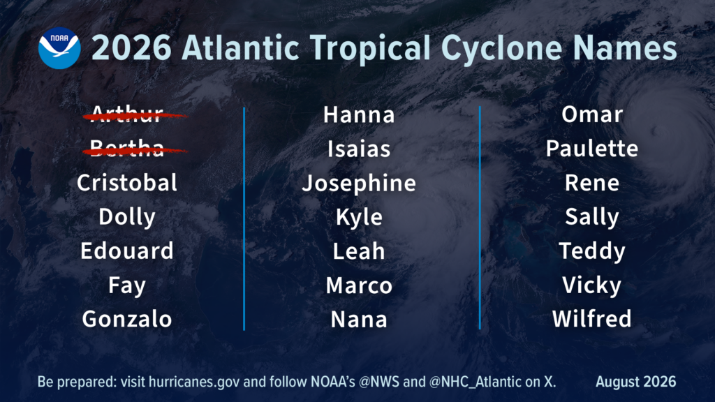
To put the projections in context, an average Atlantic hurricane season typically generates 14 named storms, seven hurricanes, and three major hurricanes. Through the first half of the 2026 season, only two named storms – Tropical Storm Arthur and Tropical Storm Bertha – have formed, and neither gained enough strength to reach hurricane status. Both systems originated in the Gulf of Mexico before making landfall in Louisiana, bringing heavy downpours to the Gulf Coast; Arthur also spawned multiple tornadoes across the region during its passage.
Ken Graham, director of NOAA’s National Weather Service, stressed that storm strength measured by wind speed does not capture the full scope of potential harm from tropical systems. “Inland rainfall is a major cause of damage from tropical storms and hurricanes, as Arthur demonstrated,” Graham noted. “That’s why it’s important to prepare for every storm that’s projected to impact your area, even if it never reaches hurricane strength.”
Forecasters confirm that the primary force limiting Atlantic storm activity this year is the strengthening El Niño, which first developed in the equatorial Pacific back in June. El Niño alters global wind patterns to increase vertical wind shear across the entire Atlantic basin – a condition that tears apart developing tropical systems before they can organize and intensify, sharply reducing the overall number of storms that form.
Matt Rosencrans, NOAA’s lead seasonal hurricane forecaster, explained that El Niño has solidified its role as the overriding climate influence for the 2026 Atlantic season. “When El Niño emerges, it usually becomes the dominant factor in total hurricane season activity, and this El Niño continues to get stronger every month,” Rosencrans said. “Compared to a mature El Niño, other mechanisms play a smaller role in determining the number and intensity of tropical storms in the Atlantic basin.”
Two secondary climate factors are also factored into the outlook: near-average sea surface temperatures across the Atlantic and a neutral West African monsoon. Forecasters note both will have far less impact on overall seasonal activity than the strengthening El Niño event.
While the Atlantic is set for a quieter than usual season, El Niño has the opposite effect on Pacific hurricane activity, pushing both the Eastern and Central Pacific basins toward above-average seasons this year. NOAA continues to project 15 to 22 named storms for the Eastern Pacific, where seven named storms – including two hurricanes and one major hurricane – have already formed, matching the above-average trajectory the agency initially predicted.
NOAA underlines one critical caveat to its seasonal outlook: the broad projection of total storm activity does not include predictions for where any individual storm will make landfall. Landfall location is determined by short-term atmospheric patterns that can only be reliably forecast roughly one week in advance, the agency notes. The U.S. National Hurricane Center continues to issue regular, updated forecasts, watches and warnings for all active tropical systems to keep at-risk coastal communities informed.