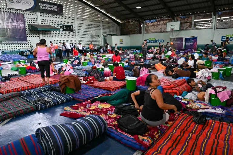
One of Central America’s most consistently active volcanoes, Guatemala’s Volcán de Fuego, continues to spew toxic ash and debris-driven mudflows weeks after its latest eruption, leaving approximately 1,700 evacuated residents stuck in temporary emergency shelters with no clear timeline to return home. Guatemalan national disaster authorities have warned that the next 72 hours will be a critical period for the region, as forecasted heavy rainfall is projected to amplify the risk of catastrophic new mudslides across surrounding communities.
The Guatemalan National Coordination for Disaster Reduction (Conred) has elevated the alert level to its highest red designation for three high-risk departments neighboring the volcano: Sacatepéquez, Escuintla, and Chimaltenango. Roughly 29,000 residents across these affected areas are already enduring ongoing exposure to hazardous ash fall, and mandatory evacuation orders remain in full effect for all at-risk zones until volcanic activity eases and conditions are deemed safe for return.
To date, mudflows stretching up to 7 kilometers have continued to flow down Fuego’s slopes, and incoming rain is expected to destabilize loose volcanic debris, worsening existing flows and creating new hazards for nearby settled areas. The volcano first erupted Monday, unleashing a powerful mix of toxic gas, volcanic ash, molten lava, and fast-moving pyroclastic flows. Volcanic activity persisted into Tuesday, with new secondary eruptions launching additional mud and ash plumes into the atmosphere.
As a preventative public health measure, Conred has issued guidance for local residents: advise covering all open drinking water stores to prevent ash contamination, and wear well-fitted face masks to reduce inhalation of fine volcanic ash. As of the latest official update, no mudflows have reached populated village centers, and no reports of structural damage to residential or public infrastructure have been confirmed.
The eruption has already upended daily life across the region. National Route 14, a major transportation artery that runs close to the volcano’s slopes near Alotenango, roughly 65 kilometers southwest of Guatemala City, has been fully closed to traffic. Additionally, all schools in nearby affected municipalities have been temporarily shuttered to avoid putting students and staff at risk.
Geographically, Guatemala sits within the Pacific Ocean’s geologically active “Ring of Fire”, a region marked by frequent tectonic activity that makes volcanic eruptions and earthquakes a regular natural hazard. Volcán de Fuego has a long history of disruptive and deadly eruptions that have forced mass evacuations in past decades. The most devastating recent event occurred in 2018, when a large-scale eruption killed 194 people and left more than 230 others unaccounted for, after hot pyroclastic flows and ash buried the villages of San Miguel Los Lotes and El Rodeo under meters of volcanic debris.