On Friday, leading regional climate and meteorology experts issued a detailed forecast outlining a series of extreme weather hazards set to impact Barbados and the entire Caribbean region through the final stretch of the 2024 wet season. The projection, published in the July–September issue of the Caribbean Climate Outlook newsletter, draws on analysis from Dr. Cedric Van Meerbeek, lead regional climatologist at the Caribbean Institute for Meteorology and Hydrology (CIMH), and Dr. Theodore Allen, a climate change specialist at the University of the West Indies’ Centre for Resource Management and Environmental Studies (CERMES).
According to the pair, the projected unstable conditions are driven by two key climate forces: a strengthening El Niño system developing over the summer months, which overlaps with the Caribbean’s wet season, and long-term anthropogenic global warming that amplifies the intensity of extreme weather events across the tropics.
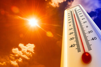
One of the most immediate risks highlighted is rising oppressive humid heat that will build through September, the traditional peak of the region’s annual heat cycle. The experts warn this warming trend will result in repeated, prolonged heatwaves, with the northernmost areas of the Caribbean facing the most severe exposure.
For the 2024 Atlantic Hurricane Season, the forecast calls for an uneven pattern of activity. Through August, storm formation will occur in irregular, scattered bursts, but the typical September peak is expected to be far less active than in average years. A key factor suppressing cyclone development is the expected frequent influx of dust-heavy Saharan air masses moving across the Atlantic into Barbados and the Eastern Caribbean, a phenomenon the authors note disrupts tropical cyclone formation. However, this same dry, dust-laden air carries its own hazards: it worsens oppressive humidity and drives widespread declines in regional air quality, raising risks for people with respiratory conditions.
Rainfall patterns will also be highly irregular over the coming two to three months. Overall, the region will see a slower increase in rainfall frequency compared to most years, which has slowed the recovery from ongoing drought conditions that will persist into September. Despite the overall lack of consistent rain, intense, short-duration heavy rainfall events are still projected to occur, and these outbursts carry a “high to extremely high potential” for flash flooding, river flooding, and cascading secondary hazards that can disrupt communities and infrastructure.
Drought remains one of the most pressing ongoing threats across multiple island nations and territories. Severe short-term drought has already been confirmed in southwest Tobago and western Barbados, while long-term drought is currently entrenched in a dozen locations across the region: easternmost Cuba, Grenada, easternmost Guadeloupe, southwest Jamaica, Martinique, southwest Puerto Rico, Saint Lucia, St. Vincent, and southeast Suriname.
Agricultural drought, which threatens crop yields and livestock health, is already developing in Saint Lucia, and the experts project it will either emerge or persist through the end of the month across the Aruba-Bonaire-Curacao (ABC) Islands, eastern Cuba, Dominica, Grenada, the Leeward Islands, Martinique, and Tobago. Short-term drought is currently evolving in Antigua and Barbuda, Grand Cayman, Martinique, northeast Puerto Rico, St. Kitts and Nevis, parts of Saint Lucia, Tobago, and the U.S. Virgin Islands, with potential development or continuation through September in the ABC Islands, Barbados, parts of Belize, and Grenada. Long-term drought is evolving in Antigua, Martinique, St. Kitts and Nevis, and Saint Lucia, with potential persistence or development through the end of November in Martinique and St. Kitts.