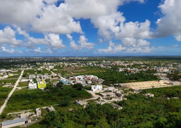
In the Verón-Punta Cana region of the Dominican Republic, a bold new urban development framework is set to transform the country’s most high-profile tourism destination, reorienting all future growth around the core principle of sustainable mobility. The Verón-Punta Cana Territorial Planning Plan (POT) proposes a systemic overhaul of the area’s transportation infrastructure, addressing growing mobility challenges that have come with the region’s rapid tourism and residential expansion.
At the heart of the proposal is a redesigned hierarchical road network that categorizes routes into four functional tiers: expressways, arterial roads, collector roads, and local roads. This clear functional separation is designed to streamline traffic flow, cut down on chronic congestion, and improve overall road safety for all users. Beyond motor vehicle infrastructure, the plan prioritizes expanding accessibility and infrastructure for non-motorized travel and shared public transit, with the explicit goal of reducing the region’s overwhelming dependence on private passenger vehicles.
Aligned with global best practices for Sustainable Transit-Oriented Development (TOD), the initiative aims to build a more interconnected, walkable community. The plan maps out integrated pedestrian paths and cycling corridors that link residential neighborhoods directly to employment hubs, commercial districts, public service facilities, and major transit stops, eliminating the common disconnect between where people live and where they work, shop, and access services.
One of the most notable innovations in the proposal is the creation of Verón-Punta Cana’s first formal, integrated bicycle lane network. Unlike recreational cycling paths that are common in many tourist regions, this network is designed to function as a core part of the area’s public transportation system. The routes will connect residential areas, workplaces, public facilities, and transit stations, and will meet strict international standards for safety, including adequate width, nighttime lighting, clear signage, and physical barriers separating cyclists from motor vehicle traffic.
To further advance the plan’s safety and sustainability goals, the proposal designates protected mobility corridors along two major regional routes: Frank Rainieri Boulevard and the Verón-Bávaro Ring Road. Within these corridors, developers will be prohibited from constructing permanent structures or adding parallel service roads, a restriction intended to preserve the corridors’ primary transportation function, reduce encroachment on public right-of-way, and create a safer, more pleasant environment for pedestrians and cyclists. The corridors will feature purpose-built pedestrian paths, separated bike lanes, and added public urban amenities to enhance user experience.