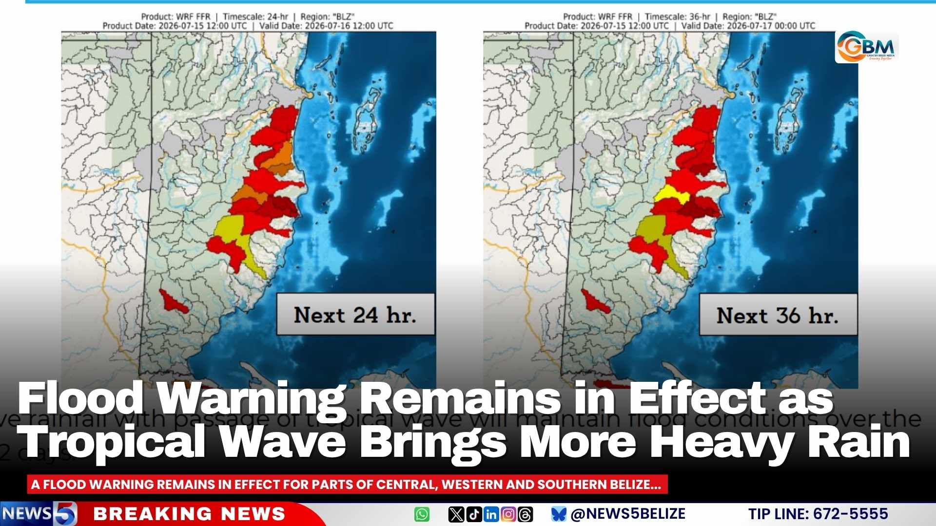
As of July 15, 2026, a continuous flood warning remains active across multiple regions of Belize, as meteorological and emergency authorities prepare for a new round of intense rainfall expected to exacerbate already dangerous flood conditions over the coming two days.
The unstable weather pattern driving this ongoing risk is a passing tropical wave, which has already dumped large volumes of rain across the country. Forecasters confirm that excessive precipitation tied to this system will sustain existing flood conditions throughout central, western and southern swathes of Belize for the next 24 to 48 hours.
The warning specifically targets Regions 9, 11 and 13, with the highest level of concern focused on small communities sited along the eastern slopes of the Maya Mountains. In these areas, rapid, unpredictable flash flooding remains a major threat to public safety. Emergency management officials have issued a formal advisory urging all local residents to keep close track of updated weather bulletins, avoid unnecessary travel in high-risk zones, and remain prepared to evacuate at short notice if conditions deteriorate.
Hydrology teams across the country are conducting continuous monitoring of river and lagoon levels to track changes in real time. As of the latest update, the Sibun River at Freetown Sibun is still sitting at official flood stage, with water levels only marginally lower than the record levels recorded during Hurricane Mitch, one of the most destructive storms to hit the region in modern history. The Belize River has shown signs of gradual improvement, with water receding at the More Tomorrow and Double Run monitoring points, while Crooked Tree Lagoon remains below normal water levels. Both the Sittee and Temash Rivers are seeing falling water levels, though the Temash River still holds levels well above the seasonal average.
In southern Belize, the Sarstoon River continues to run higher than normal. The Moho River remains above average at the Jordan monitoring station, and is only slightly below normal at Blue Creek South, while Gales Point Lagoon also holds above-average water levels. Most other major water bodies across the country, including the Rio Hondo, Mopan, Macal, Monkey, Deep and Rio Grande rivers, are currently at or below normal seasonal levels. The New River is an exception, with water levels ranging from below to above normal across different stretches of its course, depending on location.