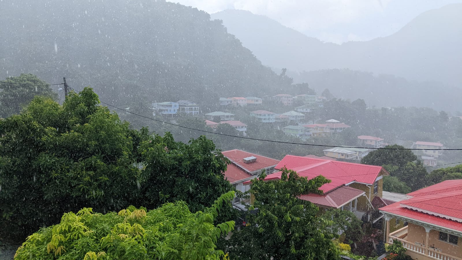
Regional weather authorities have issued a series of public safety alerts as multiple overlapping hazardous weather conditions are set to impact the area over the coming 24 hours. Forecasters confirm that a tropical wave, carrying excess atmospheric moisture and unstable air masses, will drive weather patterns across the region through the day.
Overnight and into the early morning, the system is expected to bring widespread overcast conditions alongside scattered rain showers. There is also a low but non-negligible risk of isolated thunderstorms breaking out across higher elevation and low-lying flood-prone zones. Officials are urging residents who live in areas vulnerable to flash flooding, landslides, and falling rock debris to stay updated on changing weather conditions and avoid unnecessary travel through high-risk zones through the day. By afternoon, precipitation is expected to taper off to just a few scattered showers, but strong gusty winds will remain a persistent hazard across the region.
Beyond the rain and wind, a growing plume of Saharan dust is projected to push into the region starting this afternoon, carrying significant air quality risks through overnight hours. Forecasters warn that air quality will decline from moderate to unhealthy levels as dust concentrations spike. Vulnerable populations, including individuals with asthma, chronic obstructive pulmonary disease (COPD), and other pre-existing respiratory conditions, are advised to limit prolonged outdoor exposure and keep medication on hand to manage any unexpected symptoms.
The dust will also cut down on horizontal visibility across both coastal areas and open water, prompting official warnings for commercial and recreational mariners. All boat operators are strongly encouraged to carry fully charged, functioning navigational equipment to avoid accidents while traveling through low-visibility conditions.
Sea conditions will remain unpredictable over the next day, with forecasters noting moderately choppy seas across most of the region’s coastline. Along the area’s western shore, wave heights are expected to peak around 5 feet, while eastern coastlines could see waves reaching up to 8 feet – conditions that pose significant risks to small vessels. A formal Small Craft Advisory remains in effect for all nearshore waters, with officials reminding small boat operators and recreational sea bathers to stay out of hazardous surf and avoid unnecessary offshore activity until conditions improve.