In the wake of persistent, heavy rainfall that hammered multiple regions of Belize on June 11, 2026, ongoing flash flood and river rise threats continue to loom over large swathes of the country, with official warnings extended to central and southern areas.
Three of Belize’s top emergency and environmental agencies — the National Emergency Management Organization (NEMO), the National Hydrological Service (NHS), and the National Meteorological Service — have joined forces to issue urgent alerts, urging at-risk communities to stay on high alert amid unstable meteorological conditions. In its third public information bulletin on the unfolding situation, NEMO emphasized that dynamic weather patterns are keeping flood risks elevated across much of the nation.
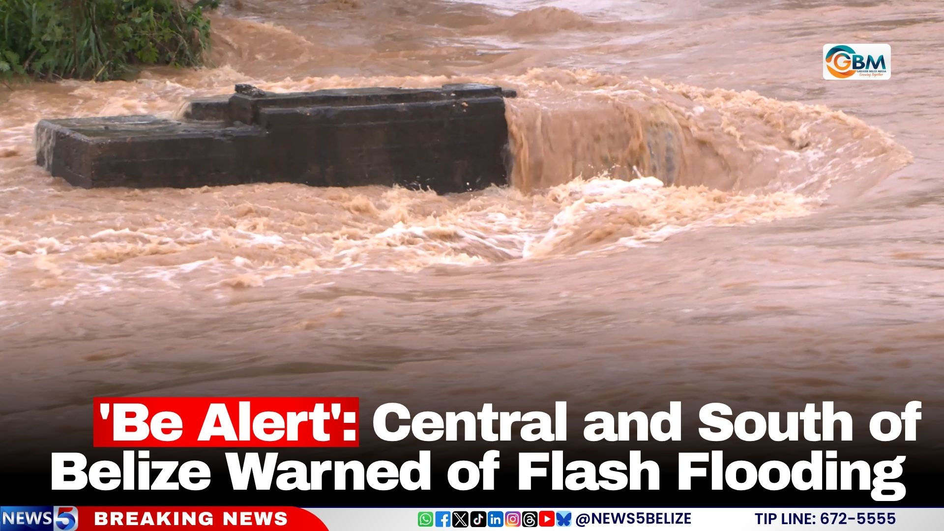
Active flood warnings are currently in place for central and southeastern Belize, with a specific focus on communities situated along the Sittee River in the Stann Creek District. Monitoring data from the NHS shows that water levels at the Kendal monitoring point on the Sittee River have already climbed past bankfull capacity, putting adjacent low-lying areas at immediate risk of inundation. Both NEMO and NHS warned that additional heavy rainfall would exacerbate existing flood conditions, triggering both urban flooding and sudden flash floods that can develop rapidly with little to no advance warning. “Take immediate action to protect your property and personal safety,” the agencies urged residents.
A separate lower-level Flood Alert remains active for western and central parts of the country, where hydrological teams are conducting round-the-clock monitoring of river levels to catch any sudden changes in conditions. Residents who make their homes near rivers, streams, and designated flood-prone zones have been instructed to maintain emergency preparedness, ready to evacuate at short notice if conditions worsen.
Infrastructure impacts are already being reported across affected regions. While most roads and bridges remain passable, officials warn that drivers must exercise extreme caution when traveling through flood-hit areas. The popular Hopkins Road, a key transport route in the region, is currently only open to high-clearance vehicles, with standard passenger cars advised to seek alternative routes.
Authorities have issued a critical safety reminder for motorists: never attempt to drive through submerged roadways, as water depths and undercurrents are often difficult to judge, and hidden debris or collapsed road surfaces can create catastrophic hazards. The public is also urged to stay alert for washed-out infrastructure, falling debris, and rapidly shifting water levels across the warning area.
As of the latest update, all three national agencies are maintaining continuous monitoring of weather and hydrological conditions across the entire country, with new bulletins set to be issued as soon as conditions change.