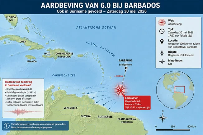
On Saturday local time, a magnitude 6.0 earthquake was registered south of the Caribbean island nation of Barbados, with faint tremors felt by dozens of residents hundreds of kilometers away in Suriname, according to regional seismic monitoring authorities.
The Seismic Research Centre at the University of the West Indies (UWI-SRC) confirmed the temblor struck at approximately 17:27 local time, with an epicenter positioned around 100 kilometers south of Bridgetown, Barbados’ capital. The earthquake’s hypocenter was measured at a depth of roughly 53 kilometers. Seismic officials noted that this data remains an preliminary automatic reading, and final figures may be adjusted following full post-event analysis.
Despite the epicenter being located a substantial distance from Suriname’s territory, residents across multiple regions of the South American country reported detecting light shaking Saturday afternoon. Accounts shared on social media indicate that people positioned on upper floors of tall buildings experienced the movement more distinctly than those at ground level.
Geographically, Barbados sits along the eastern edge of the Caribbean tectonic plate, a geologically active zone where frequent seismic activity occurs driven by shifting interactions between neighboring tectonic plates. Most earthquakes recorded in this region do not trigger major structural damage, though their tremors can often be detected across wide swathes of the Caribbean basin.
As of the latest updates, no reports of casualties, structural damage or injuries have been confirmed in Barbados or surrounding areas. No tsunami warnings have been issued by regional ocean and emergency management agencies following the quake.