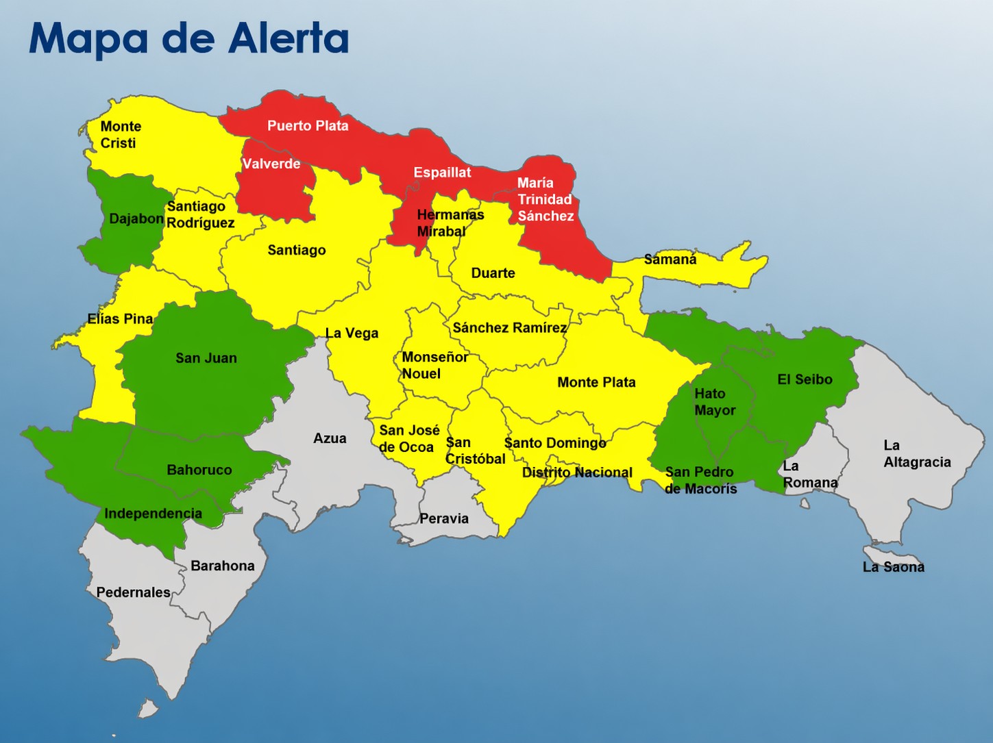
The Dominican Republic’s emergency management authorities have rolled out a three-tiered national alert system, placing four northern provinces on the highest risk red alert as adverse weather conditions threaten widespread flooding across large swathes of the country.
The four red-flagged provinces, which face the most severe potential hazards, are Puerto Plata, Valverde, Espaillat, and María Trinidad Sánchez. Beyond these high-risk zones, the country’s capital National District and an additional 14 provinces have been placed under yellow alert, signaling a moderate level of danger, while the remaining seven provinces carry the lowest-level green alert status, indicating minimal immediate risk.
The nation’s Emergency Operations Committee (COE), which manages disaster preparedness and response, confirmed that the tiered alerts were triggered by growing threats of multiple flood types. At-risk areas face potential overflow across rivers, small streams, and natural ravines, alongside the looming possibility of sudden flash floods and standing water in dense urban areas.
This latest alert update draws on official data and forecasts from two leading national institutions: the Dominican Institute of Meteorology (Indomet) and the National Institute of Hydraulic Resources (INDRHI). Technical assessments from both agencies confirm that atmospheric conditions across the country remain primed for sustained rainfall. A slow-moving trough connected to an active frontal system has kept moisture levels elevated, leaving already saturated soils in high-risk provinces far more vulnerable to runoff and flooding. Local authorities are urging residents in alert zones to monitor official updates, prepare for potential evacuation, and avoid low-lying flood-prone areas through the duration of the weather event.