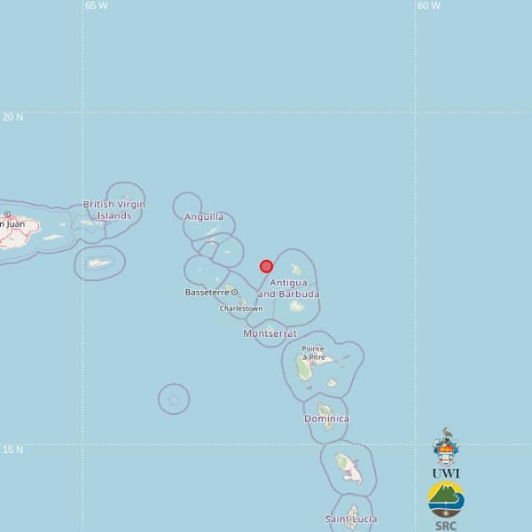
A moderate seismic event registering magnitude 3.9 occurred in the Eastern Caribbean waters during early Thursday morning, as automatically detected by the University of the West Indies Seismic Research Centre’s monitoring systems. The tremor originated at precisely 3:19 a.m. local time at significant depth beneath the ocean floor.
The earthquake’s hypocentral coordinates placed it at 17.69 degrees north latitude and 62.25 degrees west longitude, with seismic activity emanating from approximately 42 kilometers beneath the Earth’s surface. This substantial depth typically results in reduced surface shaking intensity compared to shallower quakes of similar magnitude.
Geographic positioning data indicates the seismic epicenter was situated 69 kilometers northeast of Basseterre, the capital city of St. Kitts and Nevis; 78 kilometers northwest of St. John’s, Antigua and Barbuda; and 99 kilometers north of Brades, Montserrat. The location places the event within the complex tectonic boundary zone between the North American and Caribbean plates.
The UWI Seismic Research Centre emphasized that their initial assessment was generated through automated computer algorithms without human verification. This preliminary determination remains subject to potential revision following comprehensive analysis by the agency’s seismic experts, who will examine waveform data and seismic station readings across the region.