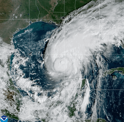
As the 2026 Atlantic hurricane season still has over six weeks remaining, the season’s first named hurricane has unexpectedly formed in the Atlantic basin, triggering urgent emergency preparedness measures across the U.S. northern Gulf Coast ahead of its projected late-week landfall.
On Thursday, Hurricane Isaias was recorded with maximum sustained winds of 85 miles per hour (140 km per hour), and federal meteorologists confirmed that further strengthening is likely as the storm system tracks toward the U.S. coastline. As of 1:00 p.m. Central Daylight Time, the storm’s central eye was positioned near 24.0 degrees North latitude and 89.8 degrees West longitude, moving east-northeast at a steady forward speed of roughly 10 mph (17 km/h). The National Weather Service projects a shift to a pure northeast trajectory later Thursday, followed by a turn to the north on Friday that will bring the storm closer to populated coastal areas.
Per the latest official forecast track, Isaias will pass just north of Mexico’s Yucatan Peninsula before advancing toward the northern Gulf of Mexico, with landfall expected between late Friday and early Saturday. Current projections point to Alabama as the most likely state to take a direct hit from the hurricane.
Forecasters have stressed that Isaias will remain a high-risk storm as it approaches the coast. Hurricane-force winds extend up to 15 miles (30 km) out from the storm’s center, while tropical-storm-force winds reach as far as 90 miles (150 km) from the core. In addition to dangerous wind damage, the system is expected to bring extreme rainfall that could trigger flash flooding, as well as embedded spin-up tornadoes across coastal and inland areas.
Local and federal emergency management agencies have already issued a range of hurricane watches, warnings, and tropical storm alerts for multiple communities along the northern Gulf Coast, with pre-landfall preparations including emergency supply staging and evacuation route checks underway. Officials are urging all residents in areas under active alerts to monitor official updates closely from local authorities and emergency management teams as the storm approaches, and to complete preparation steps as soon as possible.