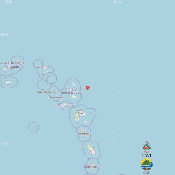
A preliminary automatic detection from the University of the West Indies Seismic Research Centre (UWI-SRC) has confirmed a magnitude 3.6 earthquake struck the waters northeast of Antigua and Barbuda in the early afternoon of Wednesday, September 23. According to the initial readout, the seismic event began at 12:09 p.m. local time, with an estimated depth of 10 kilometers below the ocean surface. Preliminary geolocation data pins the quake’s epicenter at 17.50 degrees north latitude and 61.18 degrees west longitude. This puts the seismic center roughly 86 kilometers northeast of St. John’s, the capital city of Antigua and Barbuda. Beyond the distance from Antigua and Barbuda’s capital, the epicenter also sits approximately 138 kilometers northeast of Brades, the administrative center of Montserrat, and 144 kilometers north-northeast of Point-à-Pitre, the largest city on the French Caribbean island of Guadeloupe. As of the latest update from monitoring officials, there have been no immediate reports of structural damage, injuries, or tsunamis triggered by the seismic activity. UWI-SRC has emphasized that the current epicenter location and magnitude readings were generated automatically by computer algorithms. Finalized, verified data will be released after specialist analysts at the center complete a full manual review of the seismic readings, meaning some adjustments to the initial data are possible in the coming hours.