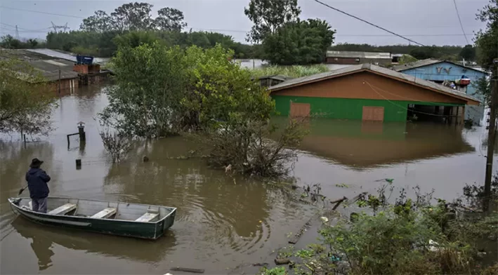
Meteorological authorities around the world have formally confirmed the return of the El Niño climate phenomenon in the Pacific Ocean, with current projections indicating this event could rank among the most powerful El Niño events recorded since systematic monitoring began in 1950. Climate experts have issued widespread warnings that this natural climate pattern will drive additional global temperature rises, amplifying a range of extreme weather events including catastrophic flooding, prolonged droughts, large-scale wildfires and intense tropical storms. The photo accompanying this report, captured by Agence France-Presse, shows a local man paddling a small boat through a flooded residential street in the Harmonia neighborhood of Canoas, a city located in Brazil’s southern Rio Grande do Sul — one of the South American regions already facing heightened rainfall and flooding risks tied to the developing El Niño.
El Niño forms when surface ocean waters along the equatorial Pacific warm significantly, triggering far-reaching shifts in global weather circulation patterns. According to the U.S. National Oceanic and Atmospheric Administration (NOAA), there is a 63% probability that this El Niño will reach its peak intensity during the Northern Hemisphere’s fall and winter months, placing it among the strongest events ever documented.
Climate researchers emphasize that the regional impacts of this El Niño will vary dramatically across the globe. Parts of South America can expect to see exceptionally heavy rainfall that increases flood risk, while India will face a higher likelihood of prolonged, dangerous heatwaves, and many regions across Africa will experience unstable, unpredictable weather conditions. On the positive side, the phenomenon is expected to ease persistent drought conditions across the Middle East and deliver beneficial weather impacts for agricultural production in the United States.
United Nations Secretary-General António Guterres has framed the arrival of this strong El Niño as an urgent climate warning signal, noting that the additional warming driven by the phenomenon could accelerate the overall trend of global anthropogenic climate change.
Even though impact levels will differ by region, the scientific community uniformly stresses that proactive preparation is critical to reduce loss of life and property. This is especially urgent because current forecasts suggest this El Niño will be both stronger and longer-lasting than the typical El Niño event. Even before its official confirmation by meteorologists, the unusually powerful developing phenomenon had already earned dramatic informal nicknames including “Super El Niño” and “Godzilla El Niño.”