Residents of the Dominican Republic are bracing for several days of disrupted weather conditions, as a combination of a low-pressure trough and an incoming humid air mass set the stage for heightened rainfall beginning Thursday, according to national meteorological officials.
Speaking from the Dominican Institute of Meteorology (Indomet), lead meteorologist Cristopher Florian explained that the combined system, paired with the south and southeastward shift of the trough, will drive a sharp rise in atmospheric moisture across the island nation. This uptick in humidity will not be limited to Thursday alone, Florian noted: rainfall will remain a prominent feature through Friday, with intense downpours, thunderstorm activity, and even a measurable risk of small hail in the country’s higher-elevation mountainous regions.
The unstable pattern will extend across the entire remainder of the week, far beyond just the Thursday-Friday window, forecasters confirmed. Even on Wednesday, conditions already mirror the unsettled trend, as the existing trough maintains its position over the region and is joined by a second trough system, triggering scattered rain events across multiple districts of the country.
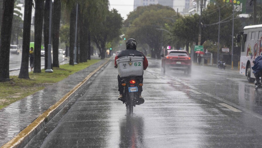
While meteorologists do not project extreme, record-breaking cumulative rainfall totals over the coming days, a key hazard remains: saturated soil from recent precipitation events has left many areas vulnerable to flash flooding and landslides, meaning existing national alert levels will stay in effect for the foreseeable future.
Forecasters have mapped out a timeline for rain progression on the current day: precipitation will first emerge across the country’s interior regions by early afternoon, with light to moderate showers expected to arrive around 1:00 p.m. in populous provinces including Puerto Plata, Santiago, Espaillat, and Hermanas Mirabal.
By late afternoon, around 5:00 p.m., rainfall activity is projected to intensify across western, central, and southern provinces including Santiago Rodríguez, San Cristóbal, San José de Ocoa, La Vega, and La Romana. For the capital city of Santo Domingo, cloud cover will begin building by 6:00 p.m., creating conditions that can quickly spawn intense localized downpours across the metro area.