标签: Dominican Republic

多米尼加共和国

  • Bridge over Camú River collapses; dozens of homes flooded and extensive damage in Puerto Plata

    Bridge over Camú River collapses; dozens of homes flooded and extensive damage in Puerto Plata

    On Saturday night, torrential downpours swept across the Dominican Republic’s Puerto Plata province, leaving a trail of widespread destruction that has disrupted communities and cut off critical transportation links. Two major bridge structures sustained serious damage, while rising floodwaters inundated dozens of residential properties across multiple municipalities.

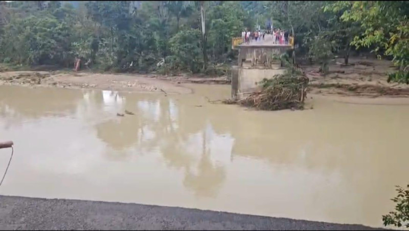
    The most critical infrastructure failure occurred on the region’s popular tourist corridor, where the Camú bridge collapsed entirely, trapping residents and cutting off access to the surrounding area. A parallel crisis unfolded in the Altos de la Boca sector of Los Hidalgos, where a second bridge was rendered impassable by flood-driven damage, creating another isolated pocket of the province.

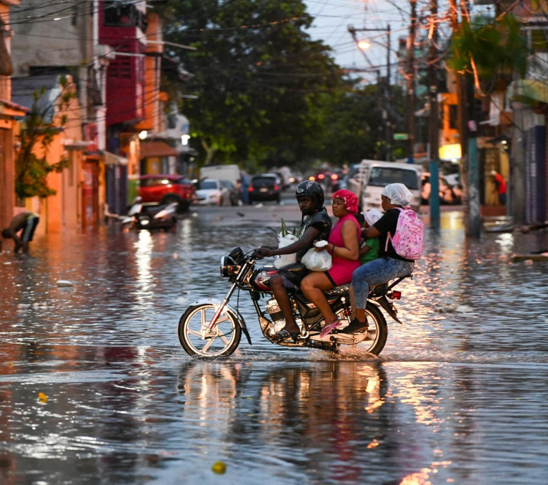
    Flooding was not limited to infrastructure damage, with multiple low-lying communities across Villa Montellano registering severe inundation. Neighborhoods including Los Ciruelos, El Tamarindo, Monte Bravo, and the La Maternidad district all reported standing floodwaters that entered residential homes. In one dramatic incident in Monte Bravo, an entire family was forced to climb onto the roof of their flooded property to escape rising waters, where they waited for rescue before being pulled to safety by teams from Amber Rescue.

    In the municipality of Imbert, communities along the Bajabonico River including Baraguana, Barrabás, and La Yaguita all saw widespread flooding as the waterway overflowed its banks. The same pattern of river-driven inundation was reported across three additional municipalities: Guananico, Altamira, and Villa Isabela, where dozens of additional homes were flooded.

    Beyond flooding and infrastructure damage, the heavy rain also triggered multiple landslides along the Puerto Plata-Navarrete highway. Slope failures were recorded in the El Copey community of Altamira, as well as at the main entrance to the highway’s tunnel, closing sections of the critical intercity route.

    In response to the crisis, José Ignacio Paliza, the Dominican Republic’s Minister of the Presidency, announced that an official emergency assessment and relief mission would launch in the early hours of Sunday. Paliza confirmed the government’s commitment to supporting impacted families in a post to his official social media account, writing, “We are heading to Puerto Plata to assist the families affected by the heavy rains of the last few hours. God is in control!”

  • Government asks the population to stay away from rivers and coasts

    Government asks the population to stay away from rivers and coasts

    Residents of the Dominican Republic are preparing for severe weather this weekend, after national authorities activated full emergency response protocols on Friday ahead of an approaching frontal system forecast to bring heavy, widespread rainfall across much of the country. The announcement followed a high-level coordination meeting led by President Luis Abinader at the National Palace in Santo Domingo, where officials confirmed the government would operate in permanent session to monitor the storm’s progression and coordinate rapid responses to any emerging hazards.

    Following the meeting, Juan Manuel Méndez, general director of the country’s Emergency Operations Center (COE), issued clear guidance to the public: all residents are asked to avoid recreational visits to coastal areas, and to cooperate fully with mandatory evacuation orders for communities located in high-risk, vulnerable zones. Méndez emphasized that public compliance is critical to preventing avoidable loss of life, stressing that non-cooperation during evacuations could put both residents and first responders at unnecessary risk.

    Two tiers of weather alerts are currently in effect across 19 provinces and the National District. Five provinces — Monseñor Nouel, Santiago Rodríguez, Santiago, La Vega, and Monte Cristi — are under yellow alert, indicating elevated risk of severe weather impacts. A green alert, signaling preliminary preparedness is required, covers the National District, the province of Santo Domingo, Elías Piña, San José de Ocoa, Monte Plata, Puerto Plata, Dajabón, Duarte (with a specific focus on the vulnerable Lower Yuna region), San Cristóbal, Valverde, San Juan, Independencia, and Bahoruco.

    According to updates from the Dominican Institute of Meteorology (Indomet), rainfall is set to begin in the early hours of Saturday and persist through the entire day. Over a 24 to 48-hour window, total precipitation accumulation is expected to reach 100 to 125 millimeters across most affected areas, driven by the combination of the approaching frontal system and an associated trough. Forecasters project rain will intensify through Saturday afternoon, bringing moderate to extreme downpours, with risks of isolated hailstorms, severe thunderstorms, and strong wind gusts. The hardest-hit areas are expected to include Greater Santo Domingo, Monte Plata, Sánchez Ramírez, Duarte, Monseñor Nouel, La Vega, Espaillat, Hermanas Mirabal, and much of the Cibao region, with particularly severe conditions forecast for the Central Mountain Range, the country’s border region, and southwestern provinces.

    Méndez warned that widespread soil saturation will increase the likelihood of flash flooding across large swathes of the country, and alert levels may be upgraded to higher tiers if the weather system intensifies beyond current projections. In addition to flood risk, Indomet has flagged hazards including urban flooding, rising water levels in rivers and streams, landslides in hilly terrain, and sudden wind gusts. The agency noted that alert levels will be updated continuously over the next 72 hours as new weather data becomes available.

    Alongside storm warnings, meteorological officials added that hot, humid conditions will persist before and after rain events, driven by warm, moist wind flow from the east and southeast. In urban areas, the heat index will reach particularly high levels, prompting Indomet to recommend that residents wear lightweight clothing, stay hydrated by drinking plenty of fluids, and limit extended exposure to direct sunlight.

    President Abinader reaffirmed the government’s commitment to proactive preparation, stating that national authorities will remain on constant alert to monitor every development of the weather system across the entire country, with resources pre-positioned to respond to any emergency that arises. “The Government will be attentive to every situation throughout the country, both to anticipate and to react in any case,” Abinader said. Méndez echoed this call for vigilance, urging all residents, even those not currently under elevated alerts, to follow guidance from civil protection agencies, monitor official weather updates closely, and avoid complacency. He added that residents should never attempt to cross swollen rivers, streams, or ravines while rain is ongoing, a leading cause of storm-related fatalities in tropical weather events.

  • What does flood insurance really cover? A guide to protecting your assets.

    What does flood insurance really cover? A guide to protecting your assets.

    As extreme weather events grow more frequent across the globe, homeowners and vehicle owners face increasing urgency to understand the fine print of their insurance policies to safeguard their valuable assets. Leading insurance provider Mapfre has recently broken down common misconceptions around flood and water damage coverage, highlighting critical gaps that many policyholders only discover after disaster strikes.

    For residential and commercial multi-risk property policies, Mapfre’s Technical Director of General and Property Insurance Yesenia Vásquez confirmed that flood protection is included as a standard feature in most contracts. However, the company warns of a common cost-cutting choice that leaves many property owners unprotected: customers can opt to voluntarily remove flood coverage from their policy to reduce their annual premium. While this choice lowers immediate costs, Vásquez emphasized that it can lead to devastating financial losses when extreme flooding occurs.

    Mapfre also draws a clear technical distinction between flooding and other forms of water damage that are not covered by standard flood policies. For insurance purposes, flooding is officially defined as water originating outside a property that inundates and penetrates the building, damaging both the structural core (including walls and flooring) and personal or commercial contents such as furniture and equipment. In contrast, Vásquez noted that water damage resulting from internal issues like clogged pipe leaks, failing roof seals, or general poor maintenance does not qualify as flooding, and these claims will be denied under standard flood coverage. These types of damage are considered the responsibility of the property owner, who is expected to complete routine upkeep to prevent avoidable failures.

    When it comes to personal and commercial vehicles, the rules around water damage coverage differ significantly from property policies. Francisco Pérez Cuevas, Mapfre’s Technical Director of Auto Insurance, explained that water and flood damage is never included as an automatic feature of basic auto insurance policies. Instead, drivers must add this coverage as a separate add-on to their existing contract to be protected.

    Pérez Cuevas also pushed back against the widespread marketing term “full coverage insurance”, noting that this phrase is more of a promotional tool than a technically accurate description of a policy. “Many consumers assume that a ‘full coverage’ policy protects them against every possible risk, but that simply is not the case,” he explained. “It is essential that every policy holder review their specific coverage line-by-line, and explicitly ask their insurance provider whether their contract includes water and flood damage for their vehicle.”

    To help property and vehicle owners avoid costly surprises when filing a claim, Mapfre experts have outlined three core checks every insured person should complete before disaster strikes:

    First, always distinguish between flooding and routine leaks. Insurance is designed to cover extraordinary, external natural events, not damage that results from a property owner’s failure to complete routine maintenance on internal systems like pipes and roofs.

    Second, verify that both the physical structure of your property and all personal or commercial contents inside are explicitly included in your flood coverage. Flooding can damage everything from a building’s foundation to household appliances, and gaps in coverage can leave major costs uncovered.

    Third, never assume coverage based on the marketing name of your policy. Always ask your insurance advisor to provide a full written breakdown of all excluded risks, so there is no confusion when you need to file a claim.

    At its core, effective asset protection against rising extreme weather relies on more than just paying insurance premiums. It requires a clear understanding of exactly what your policy covers, and where exclusions apply. The difference between recovering your property after a flood and suffering a total financial loss often comes down to reviewing the details of your insurance contract before a disaster occurs.

  • Dominican Republic increased the number of provinces under Red Alert for 4 Provinces due to heavy rain and flood risk

    Dominican Republic increased the number of provinces under Red Alert for 4 Provinces due to heavy rain and flood risk

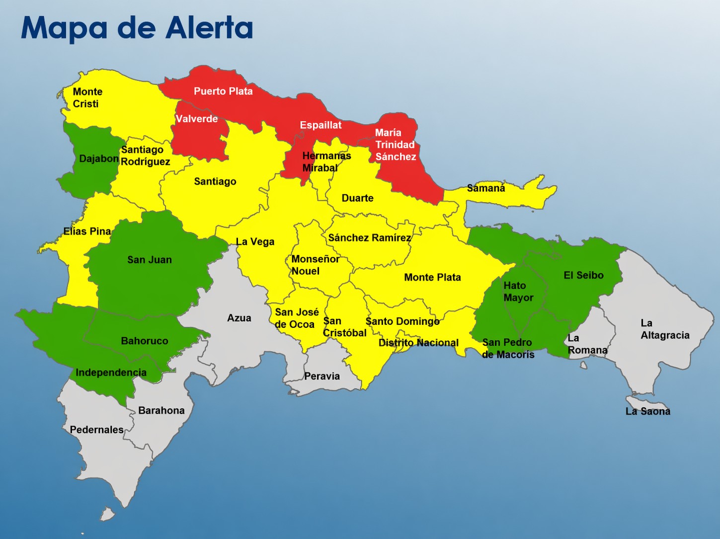
    The Dominican Republic’s emergency management authorities have rolled out a three-tiered national alert system, placing four northern provinces on the highest risk red alert as adverse weather conditions threaten widespread flooding across large swathes of the country.

    The four red-flagged provinces, which face the most severe potential hazards, are Puerto Plata, Valverde, Espaillat, and María Trinidad Sánchez. Beyond these high-risk zones, the country’s capital National District and an additional 14 provinces have been placed under yellow alert, signaling a moderate level of danger, while the remaining seven provinces carry the lowest-level green alert status, indicating minimal immediate risk.

    The nation’s Emergency Operations Committee (COE), which manages disaster preparedness and response, confirmed that the tiered alerts were triggered by growing threats of multiple flood types. At-risk areas face potential overflow across rivers, small streams, and natural ravines, alongside the looming possibility of sudden flash floods and standing water in dense urban areas.

    This latest alert update draws on official data and forecasts from two leading national institutions: the Dominican Institute of Meteorology (Indomet) and the National Institute of Hydraulic Resources (INDRHI). Technical assessments from both agencies confirm that atmospheric conditions across the country remain primed for sustained rainfall. A slow-moving trough connected to an active frontal system has kept moisture levels elevated, leaving already saturated soils in high-risk provinces far more vulnerable to runoff and flooding. Local authorities are urging residents in alert zones to monitor official updates, prepare for potential evacuation, and avoid low-lying flood-prone areas through the duration of the weather event.

  • Santiago Civil Defense highlights the preventive work of the Santiago City Council in the face of rains

    Santiago Civil Defense highlights the preventive work of the Santiago City Council in the face of rains

    As forecasters warn of incoming heavy precipitation across the Dominican Republic’s Santiago province, local Civil Defense leadership has publicly commended the proactive flood risk reduction work led by Santiago’s municipal mayor, Ulises Rodríguez.

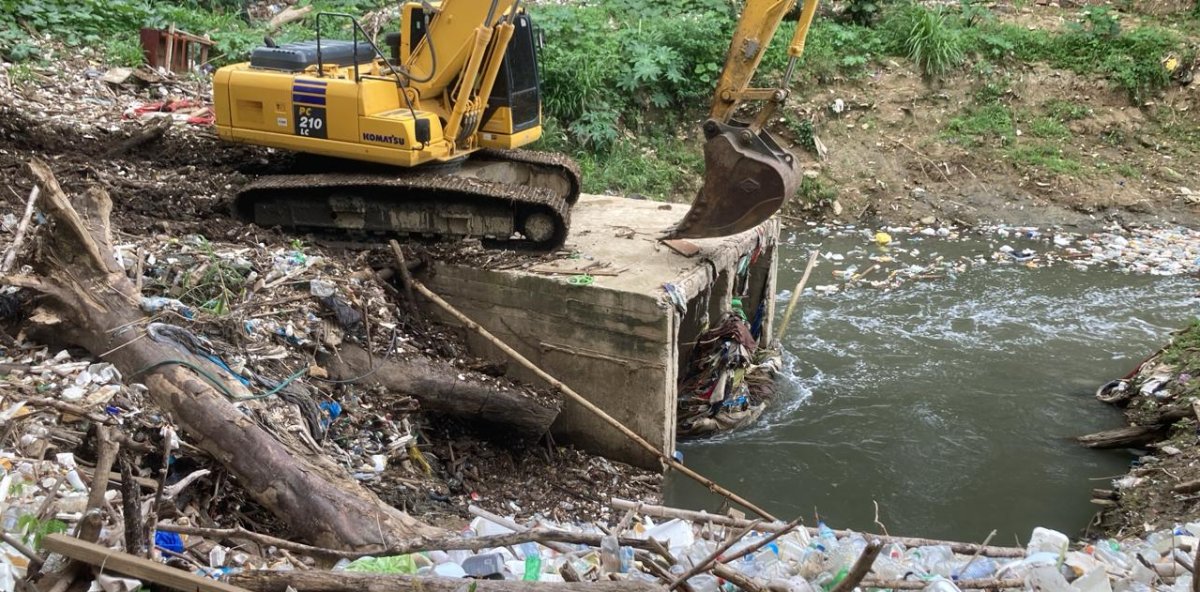
    Francisco Arias, regional director of the Dominican Civil Defense, highlighted that the municipal government has prioritized critical pre-storm preparedness tasks across high-risk neighborhoods and geographic hotspots. These interventions include clearing debris from natural ravines, unclogging urban drainage systems, removing accumulated waste from bridge approaches, collecting scattered solid waste from residential areas, and pruning overgrown tree branches that could threaten infrastructure during storms.

    The work has already been fully rolled out across a range of priority zones, Arias confirmed, including 20th Street, 8th Street, the communities of Nibaje and Hoya de Caimito, and the high-risk Devil’s Ravine — all locations long identified as prone to dangerous waterlogging during heavy downpours. Beyond the physical infrastructure work, Arias noted that municipal crews have maintained a consistent, visible presence in these flood-prone areas to respond quickly to emerging hazards as the rain approaches.

    In his remarks, Arias also extended recognition to Arismendi Dajer, the municipal government’s general secretary, and the full team of local municipal staff who have collaborated to advance the preparedness campaign.

    Arias explained that pre-event mitigation is a core component of effective disaster management: by addressing hazards before storms hit, officials can dramatically cut the risk of destructive flooding and keep local residents safe. “Our Civil Defense teams have been continuously moving through vulnerable neighborhoods to share safety guidance with residents, and the Mayor’s Office has complemented that work with on-the-ground infrastructure upgrades that directly reduce flood risk,” he explained.

    All of these coordinated actions fall under a broader, holistic disaster preparedness strategy designed to protect both the lives and property of Santiago residents, Arias added, emphasizing that the municipal government remains in a constant state of readiness to address any weather-related emergency.

    In a final update, Arias confirmed that the interagency Prevention, Mitigation, and Response Committee (PMR) has already been activated, with round-the-clock monitoring of shifting weather conditions already underway. Since the previous day, Civil Defense response brigades have been door-to-door in at-risk communities, walking local families through the key safety steps they should follow if flooding does develop.

  • Why is it raining so much in April in the Dominican Republic: climatic causes explained

    Why is it raining so much in April in the Dominican Republic: climatic causes explained

    The Dominican Republic is facing an extraordinary and alarming weather anomaly this April: far outside the country’s typical seasonal rainfall patterns, days of extreme, high-volume downpours have shattered historical averages, leaving residents and experts grappling with a shift that is already upending thousands of lives. Meteorologists with the nation’s leading weather agency have traced the abnormal precipitation directly to human-driven climate change, sounding a clear alarm about shifting seasonal patterns across the Caribbean.

    Cristopher Florian, a veteran meteorologist at the Dominican Institute of Meteorology (Indomet), told local outlet HOY that rising global ocean temperatures are the primary driver of this extreme weather. As seas warm, they evaporate at a faster rate, pumping far more water vapor into the atmosphere than historical baseline conditions. This extra moisture creates the ideal conditions for far more intense, concentrated bursts of rainfall that far exceed what is normally expected for this time of year.

    Florian noted that this deviation from historic patterns is not an isolated event: for the past three consecutive years, April rainfall totals in the Dominican Republic have consistently outpaced long-term averages, driven by persistent anomalies in large-scale atmospheric circulation. Under normal seasonal cycles, the country’s wet convective season does not begin until mid-to-late April, when typical seasonal rainfall ramps up. In recent years, however, this active rainy period has been starting earlier and bringing more intense precipitation than ever recorded – a clear marker of broader climate disruption, according to Florian.

    The scale of the recent downpours is unprecedented in modern records for the month. On April 8, a low-pressure trough swept across multiple regions of the country, dumping extreme rainfall across populated areas. In the Ensanche Julieta neighborhood of the National District, the storm dropped 314 millimeters of rain in just a matter of hours – a volume that would be extreme even in the heart of the wettest months of the year.

    The impacts of this extreme weather extend far beyond disrupted climate patterns, causing widespread harm to local communities. The Dominican Republic’s Emergency Operations Center (COE) released an updated damage assessment Thursday that paints a stark picture of the human cost: more than 1,000 residential properties have been damaged by floodwaters and associated hazards, with dozens completely leveled by flash flooding and mudslides. In total, officials confirmed 1,024 homes sustained damage, 23 of which were partially destroyed and 32 fully reduced to uninhabitable ruins. More than 5,100 residents have been displaced from their homes and relocated to government-designated emergency safe shelters across the hardest-hit regions.

  • Despair continues in the wake of floods caused by heavy rains

    Despair continues in the wake of floods caused by heavy rains

    On the early morning of April 7, after hours of intense sustained rainfall, catastrophic flash flooding swept through neighborhoods across the National District and West Santo Domingo, leaving thousands of residents displaced, their homes and livelihoods destroyed in a matter of hours.

    For many families, the disaster unfolded in the dead of night, forcing them to flee their rising properties with only their children clutched in their arms and no prearranged safe shelter to turn to. Many still struggle to process the sudden loss of everything they spent years building.

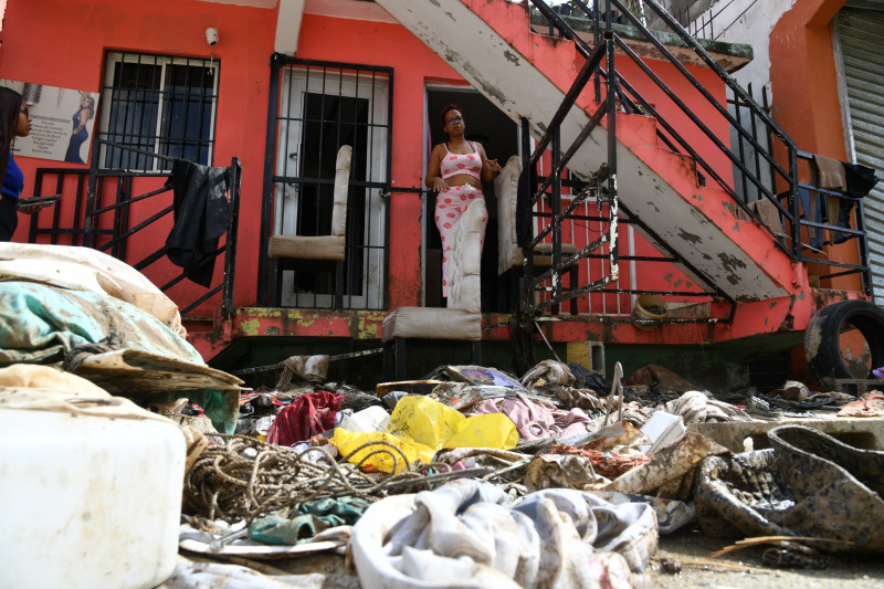
    In the La Yuca neighborhood’s Las 800 zone, named for the local ravine that breached its banks, dozens of households lost nearly all their possessions. Electrical appliances including refrigerators, televisions and radios were completely ruined, while beds, sofas, dining sets, stored food and entire wardrobes were left waterlogged and caked in thick mud. Even days after the floodwaters receded, affected residents recount the experience with raw anguish, recalling crying frightened children and the total disorientation of having no emergency plan in place.

    As residents work to clear meters of mud and standing water from their homes and wash the few belongings they managed to salvage, many have described overwhelming feelings of helplessness over the limited official support they have received. For days after the flood, the only government intervention was municipal street cleaning, with a single truck of prepared meals arriving later for distributed pickup. Local community groups and educational institutions have stepped in to fill the gap in aid.

    The Republic of Costa Rica School, which is supporting 112 displaced families from the area, has launched a donation drive targeting state agencies and local residents. Already, community members have donated clothing and shoes for school-aged children from affected households. School principal Regina Rodríguez explained that the campus has been converted into an official donation collection center. “Once we have gathered most of the donations, families will be able to come to our school auditorium to pick up canned goods, shoes, sheets and other essential supplies that they need right now,” she said.

    During an on-site visit to affected zones, observers documented dozens of submerged vehicles abandoned along flooded streets, alongside municipal crews from the National District City Council and technicians from the Santo Domingo Water and Sewer Corporation (CAASD) working to clear mud that was blocking pedestrian access to local thoroughfares.

    Many local residents linked the extreme flooding to poorly planned drainage infrastructure work in the area. “I have lived here for more than 30 years, and my home has never flooded anywhere near this bad,” said Mary, a local resident whose entire home inventory was damaged by the floodwaters. “This all happened after they started construction on the local drainage ditch.” Community representatives have formally requested that the mayor’s office provide replacement mattresses for the hundreds of residents who lost theirs in the flood.

    In the Las Plantitas area of the Los Girasoles Segundo neighborhood, piles of waterlogged personal belongings stacked outside front gates and mud-caked clothing dragged out to air are the new normal for residents after the nearby ravine overflowed. Affected families report that while a single supply truck carrying beds and food did arrive, only a small number of households received assistance, leaving those living closest to the ravine with no support at all. Residents have also issued urgent calls for water trucks, noting that running water has been cut off in the area for 15 days, leaving them unable to even wash mud out of their flood-soaked clothing.

    “I’m hanging everything out to dry unwashed because there’s not a drop of water to be had, and no one is bringing us any,” explained Ana Ramona Sánchez, a Los Girasoles Segundo resident whose entire home was flooded overnight. “Last night, I stayed trapped on my bed behind a locked door holding back floodwater until the waters receded at dawn.”

    At the local Colegio Profesora Margarita Báez, the flood damaged critical student academic records, with many that could be recovered laid out in school yards to dry out. The school lost all of its computers, speakers and other electronic equipment. Principal Alejandrina Severino also linked the disaster to unregulated construction. “Water flooded the main office and all downstairs classrooms because construction is being done directly in the ravine, and loose construction debris trapped floating trash, which blocked the water from draining,” she said.

    In the Hato Nuevo and San Miguel neighborhoods of Manoguayabo, flooded streets left residents with total loss of household belongings. Many long-term residents described this rainfall as the most severe they have ever witnessed, noting that even in past storm events, flooding was never severe enough to force families to flee into the night with small children. “We kept moving from house to house trying to stay dry, until every one filled up with water,” recounted Elaina Martínez, who fled with three young children including a newborn. “The Emergency Operations Center (COE) sent a boat to evacuate us to the main avenue, where we could go stay with relatives. It was absolutely horrifying.”

    Today, beds, furniture and waterlogged clothing line the curbs outside Manoguayabo homes, discarded after being destroyed by mud and floodwater. Many residents are openly grieving as they clean up the few possessions they can salvage.

    In Los Alcarrizos, the heavy rains caused the Lebrón Creek to burst its banks, triggering catastrophic flooding that swept several people away in fast-moving currents. Local community members managed to pull the trapped residents to safety before emergency crews arrived. “It was an absolute disaster,” recalled Carolina Rojas, who was injured when a nail pierced her foot as she fled. “Around 2 a.m., the creek rose in seconds, flooding every house in the area. Two elderly people were swept away by the current, and we managed to pull them out with a rope. They’re still in the hospital now. Nothing like this has ever happened here before, but these rains destroyed everything, and you just saw people running, clutching their children to get out.”

    In the wake of the disaster, displaced families have been staying with neighbors and extended relatives out of fear of further flooding, only beginning to return to their properties after the COE removed the province of Santo Domingo from its official flood alert list.

  • Rain will begin in the early morning and will continue throughout Saturday, reports Indomet.

    Rain will begin in the early morning and will continue throughout Saturday, reports Indomet.

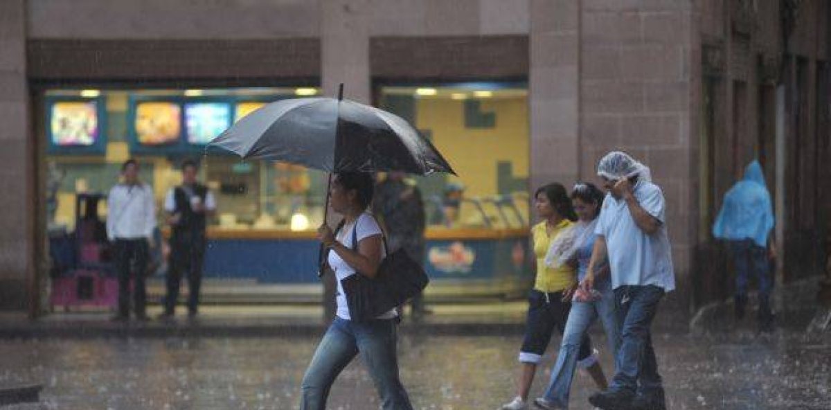
    SANTO DOMINGO – The Dominican Institute of Meteorology (Indomet) has issued public warnings that an approaching trough connected to a frontal system is set to trigger widespread heavy rainfall across more than a dozen of the country’s provinces, bringing with it a suite of potentially hazardous weather conditions over the coming three days.

    According to Indomet’s official forecast, the incoming precipitation will range from moderate to intense downpours, accompanied by sudden thunderstorms, strong wind gusts, and even isolated hailstorms in vulnerable regions. The first areas expected to feel the impact of the system include communities across Hato Mayor, Monte Plata, Sánchez Ramírez, Duarte, San José de Ocoa, Monseñor Nouel, La Vega, Santiago, Santiago Rodríguez, Dajabón, Elías Piña, San Juan, Puerto Plata, Espaillat, and Valverde, among other northern and central jurisdictions.

    By the early hours of Saturday, the trough’s advance will push scattered showers of varying intensity along the country’s entire Caribbean coastline, with precipitation forecast to persist through the full day. Indomet’s meteorologists note that rainfall will ramp up in intensity through Saturday afternoon, when residents across Greater Santo Domingo, Monte Plata, and most Cibao-region provinces can expect moderate to heavy downpours. The highest risk of severe weather — including isolated hail, thunderstorm activity and gusty winds — will be concentrated along the Central Mountain Range, the country’s western border with Haiti, and southwestern Dominican provinces.

    In response to the projected weather event, Indomet’s National Forecast Center has activated a multi-tiered system of warnings and alerts, highlighting the elevated risk of urban flash flooding, swelling rivers and creeks, sudden landslides, as well as ongoing severe wind and thunderstorm activity. Officials cautioned that existing alert levels could be updated over the next 24 to 72 hours as new meteorological data becomes available and the system progresses.

    As of the latest advisory, ten provinces are placed under full alert for hazardous weather: Monte Cristi, Monseñor Nouel, Bahoruco, Independencia, Monte Plata, San Juan, Dajabón, Puerto Plata, Elías Piña, and Santo Domingo. Three additional provinces — La Vega, Santiago, and Santiago Rodríguez — are currently under a lower-level weather advisory.

    Despite the incoming rain, Indomet forecasts that high temperatures will remain a concern for residents through the duration of the event. Warm, humid wind flow from the east and southeast will keep air temperatures elevated, particularly during afternoon hours, with urban areas facing even higher heat index values that can pose health risks to vulnerable groups. To prevent heat-related illness, the institute has issued public guidance advising residents to wear loose, light-colored clothing, maintain consistent hydration by drinking plenty of water, and limit extended exposure to direct sunlight during peak heat hours.

  • Is there evidence or not? What Public Health says about the alleged circulation of a new COVID-19 variant in the Dominican Republic

    Is there evidence or not? What Public Health says about the alleged circulation of a new COVID-19 variant in the Dominican Republic

    The Dominican Ministry of Health has issued an official update confirming that as of the latest monitoring cycle, no trace of the BA.3.2 SARS-CoV-2 subvariant, nicknamed “Cicada”, has been detected circulating within the country’s borders.

    Data compiled from the nation’s national sentinel surveillance infrastructure and integrated laboratory network has not returned any positive identifications of the new subvariant to date. Dominican health authorities maintain an active, continuous, and evidence-driven epidemiological monitoring framework designed to catch emerging viral variants at the earliest possible stage, enabling rapid public health response.

    Looking at the broader respiratory virus landscape for 2026, health officials have recorded a sustained circulation pattern of common seasonal respiratory pathogens across the first 12 epidemiological weeks of the year. Influenza strains, specifically influenza A (including H1N1 and H3N2 subtypes) and influenza B, have emerged as the dominant circulating viruses. Pre-emptive vaccination rollout launched late last year has already been deployed to mitigate the impact of influenza B, with the goal of reducing overall disease burden across the Dominican population.

    Beyond influenza, health authorities have also documented ongoing circulation of other common seasonal respiratory viruses, including adenovirus and parainfluenza. Officials note that the current pattern of multiple viruses co-circulating aligns with expected seasonal epidemiological behavior for this time of year, with no unexpected deviations detected so far.

    Eladio Pérez, Deputy Minister of Collective Health, emphasized the critical role of the national surveillance system in protecting public health. “The sentinel surveillance we have implemented across the country enables us to detect respiratory events early and rapidly, including the identification of never-before-seen viral variants,” Pérez explained. “This proactive capability directly strengthens the health system’s ability to respond effectively to emerging threats.”

    According to the ministry, all public health decision-making is rooted in real-time epidemiological data, pulled together from multiple sources including hospital epidemiology services, Provincial Directorates and Health Areas (DPS/DAS), and the national network of laboratories. This integrated data ecosystem ensures that policies and responses are always aligned with the actual on-the-ground situation.

    To help the public protect themselves against circulating seasonal respiratory viruses, the Ministry of Health has reminded the population of core evidence-based preventive measures. These include frequent hand washing, particularly before meals and after using restroom facilities; wearing a face mask when experiencing respiratory symptoms; maintaining physical distance from others while ill; and seeking prompt medical care if any warning signs of severe illness develop.

    The ministry will continue maintaining constant, close monitoring of the national epidemiological situation, working in coordination with global health organizations and aligning with international alert protocols. All ongoing efforts are focused on protecting the health and well-being of the Dominican population against emerging and seasonal respiratory virus threats.

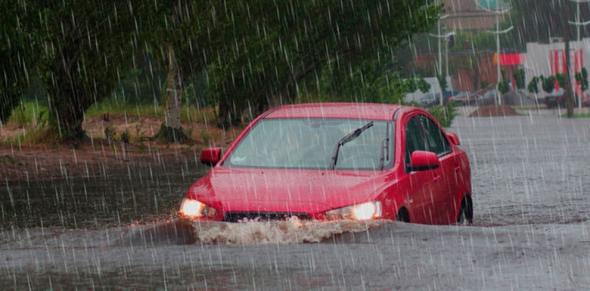
  • The most common mistake when driving in the rain that can be very expensive

    The most common mistake when driving in the rain that can be very expensive

    For motorists globally, navigating rain-soaked roadways ranks among the deadliest common driving scenarios, yet a dangerously pervasive mistake continues to put thousands of lives at risk every wet season: drivers refusing to adjust their speed and following distance from what they use on dry pavement. When asphalt and concrete turn slick from falling rain, the friction between vehicle tires and the road surface drops dramatically, cutting down grip and doubling the amount of time a vehicle needs to come to a complete stop after a driver hits the brakes. Despite this well-documented risk, large numbers of commuters and recreational drivers consistently underestimate how much wet conditions alter road dynamics, operating their vehicles exactly as they would on a clear, dry day. The outcome of this complacency is often catastrophic: drivers lose control of their vehicles, trigger multi-car pileups, cause extensive, costly property damage, and too often result in serious injury or death. Leading road safety experts, including veteran specialist Anibal Germoso, have outlined clear, actionable adjustments all drivers should make when driving in wet conditions. Germoso and his peers advise cutting travel speed by a minimum of 30 percent compared to dry conditions, expanding the gap between one’s vehicle and the car ahead to allow for longer stopping times, activating low-beam headlights to boost both a driver’s own visibility and make their vehicle more noticeable to other road users, and avoiding any sudden turns, lane changes, or hard braking that can cause a loss of traction. Beyond in-the-moment driving adjustments, experts also stress the critical importance of pre-trip vehicle maintenance, specifically checking tire tread depth and brake functionality before heading out during rainy season, when wet roads are a constant hazard. This issue carries particular urgency in the Dominican Republic, where rainfall is often both extremely heavy and arrives with little advance warning, turning road conditions dangerous in minutes. In this Caribbean nation, the common habit of failing to adjust driving for rain has become a major, underrecognized risk factor for traffic fatalities and collisions. The country’s General Directorate of Land Transportation has recently doubled down on public outreach to remind drivers that prevention is the single most effective tool to avoid rain-related crashes. The agency emphasizes that even a small moment of carelessness behind the wheel on a wet road can carry devastating costs, both in terms of lost human life and destroyed or damaged property.