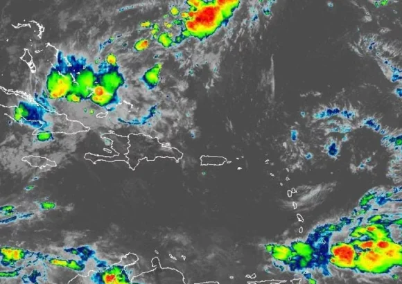
The Dominican Institute of Meteorology (Indomet) has released a detailed weather forecast for this Sunday, outlining a mix of atmospheric conditions, persistent heat, and updates on two Atlantic tropical systems that currently pose no danger to the nation.
According to Indomet’s projections, most of the Dominican Republic will wake up to a blend of partial sunshine and hazy overcast skies on Sunday. This initial sky condition is driven by two key atmospheric factors: a dominant anticyclonic system that stabilizes conditions near the surface, and light concentrations of fine dust particles carried across the Atlantic from the Sahara Desert.
While the morning and early afternoon will remain largely calm, meteorologists warn that conditions will shift by the later afternoon. An upper-atmosphere trough linked to a distant frontal system, when combined with intense daytime solar heating and local topographical effects, will create enough atmospheric instability to trigger sudden downpours, rumbling thunderstorms, and gusty wind bursts across inland regions of the country.
Indomet has identified 10 northern and central provinces that are most likely to see these stormy conditions: La Vega, Santiago, Santiago Rodríguez, San Juan, Dajabón, Monte Cristi, Valverde, Puerto Plata, Espaillat, as well as adjacent areas surrounding these localities. Forecasters added that the rain activity could linger into the early overnight hours, bringing moderate wet accumulation to some communities.
Beyond the chance of afternoon storms, the agency emphasized that the ongoing stretch of hot weather will continue through Sunday, with elevated heat index values recorded across most of the national territory. To help residents avoid heat-related illnesses such as heat exhaustion or stroke, Indomet has issued a series of public health advisories. The guidance urges people to stay consistently hydrated by drinking plenty of water throughout the day, opt for light, loose-fitting, pale-colored clothing that reflects sunlight, avoid prolonged unprotected exposure to direct sun between 11 a.m. and 4 p.m. when UV and heat levels peak, and prioritize staying in cool, well-ventilated spaces during the warmest parts of the day.
In its weekly tropical cyclone outlook, Indomet also provided updates on two active weather systems in the Atlantic Ocean. The first, Tropical Depression Fay, is currently churning over open Atlantic waters more than 1,840 kilometers west of the Azores archipelago. The system carries maximum sustained winds of 55 kilometers per hour and is tracking slowly southward at a speed of 6 kilometers per hour. Based on its current position and projected trajectory, Fay does not pose any threat to the Dominican Republic’s land or coastal areas.
The second system under monitoring is a broad area of low pressure located southeast of Bermuda. Meteorologists give this disturbance a 10% probability of strengthening into a tropical cyclone over the next 48 hours, and a 20% chance of development over the coming seven days. Like Tropical Depression Fay, this low-pressure system’s location and forecast path mean it also carries no threat to Dominican territory at this time.