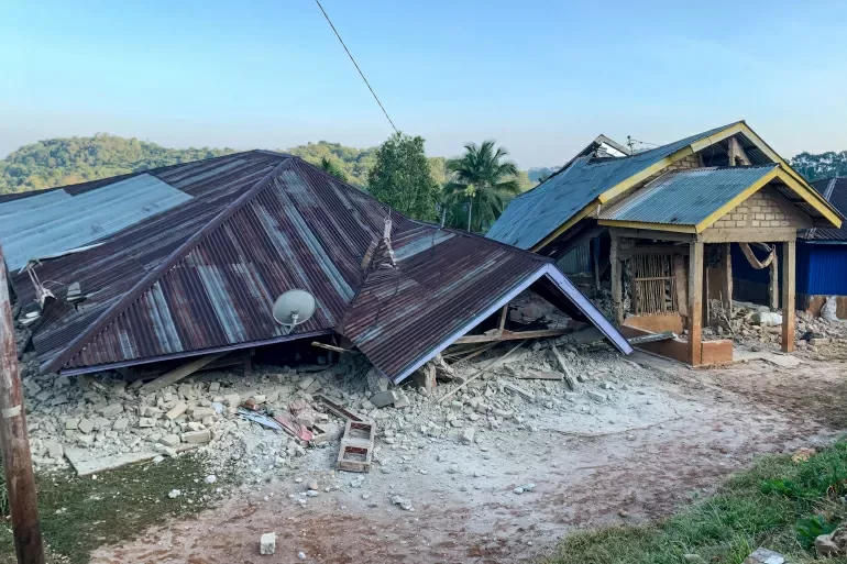
A powerful 7.7-magnitude earthquake has claimed at least 38 lives on Indonesia’s Flores island, leaving widespread destruction and triggering urgent rescue efforts across the affected region. The seismic event struck at 5:58 a.m. local time on Saturday, with its epicenter located roughly 68 kilometers northwest of the coastal city of Ende, in East Nusa Tenggara province.
Three strong aftershocks, measuring magnitudes 5.9, 5.6, and 6.1 respectively, hit the area within hours of the main quake, compounding the initial damage. The earthquake left a trail of destruction across multiple districts, damaging hundreds of residential homes, commercial warehouses, and public government buildings. Landslides triggered by the shaking have blocked key arterial roads, cutting off access to remote hard-hit communities and significantly hampering rescue and relief teams as they work to reach trapped survivors.
As of the latest update from local disaster management authorities, the 38 confirmed fatalities are spread across four cities on Flores. Two people remain trapped under collapsed building rubble in the nearby Manggarai region, with rescue crews working around the clock to extract them alive. “Our absolute priority right now is locating any survivors trapped beneath debris,” explained Fathur Rahman, head of the local rescue unit based in Maumere. Many impacted zones remain inaccessible due to landslide debris and damaged critical infrastructure, slowing the progress of search operations.
In Nagekeo, the district closest to the earthquake’s epicenter, roughly 2,000 residents have been evacuated to higher, safer ground to avoid further risks. Mobile communication signals have been disrupted across large swathes of the impacted area, creating major delays in information gathering and damage assessment. Local officials have issued repeated warnings urging residents not to return to damaged or structurally compromised buildings, due to the persistent threat of additional aftershocks that may hit in coming days.
Shortly after the main earthquake, Indonesia’s Meteorology, Climatology and Geophysics Agency (BMKG) issued an urgent tsunami warning for all coastal areas adjacent to the quake zone. The warning was later lifted after monitoring confirmed no dangerous sea level anomalies had developed, but the agency still advised residents to avoid low-lying beach areas and river banks and stay on higher ground as a precaution. BMKG has announced it will continue continuous monitoring of sea levels in the region out of an abundance of caution.
Preliminary estimates indicate more than 500,000 people on Flores experienced violent shaking from the quake, while millions more across adjacent regions reported moderate to strong tremors. With many structures damaged or destroyed, the full extent of human harm and economic damage is still being counted as survey teams work to reach cut-off areas.
Indonesia sits along the Pacific Ring of Fire, a geologically active zone marked by frequent tectonic movement that makes the nation highly vulnerable to major earthquakes and tsunamis. In 1992, a similarly powerful earthquake off the coast of Flores triggered a devastating tsunami that killed an estimated 2,500 people.
Despite the ongoing challenges of blocked routes, disrupted communications, and lingering aftershock risks, rescue operations are continuing at full pace. Local disaster management officials say they are prepared for additional aftershocks that may persist over the next several days, and have pre-positioned emergency supplies to support displaced residents.