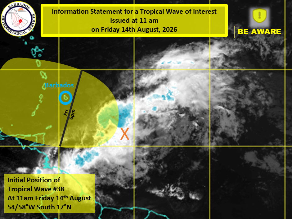
Barbados has been placed under a high-wind advisory as a tropical wave already battering the island is forecast to gain strength through the rest of the day and into overnight hours. Meteorological officials report the unstable weather system is currently positioned roughly 290 miles, or 500 kilometers, east-southeast of the Caribbean island.
Alongside the high-wind advisory, two additional warnings remain in force: a Small Craft Warning and a High Surf Warning. The already gusty winds have churned up dangerous conditions for mariners and coastal areas across Barbados, putting small vessels and beachgoers at significant risk.
According to the Barbados Meteorological Services (BMS), cloudy conditions and shower activity will begin building steadily by late afternoon. The heaviest precipitation is projected to peak overnight, continuing into Saturday. Forecasters also warn that excess accumulated rainfall and severe thunderstorms are likely scenarios, which could prompt the issuance of flash flood watches or warnings and severe thunderstorm alerts as the system moves across the island.
In a key note of reassurance, the BMS added that the tropical wave has stayed structurally disorganized throughout its approach. At this stage, there is no chance the system will strengthen into a named tropical cyclone during its time impacting Barbados.