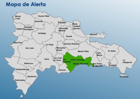
On Tuesday, authorities in the Dominican Republic activated a green alert for the country’s two most populated regions — Greater Santo Domingo and San Cristóbal — as an approaching tropical wave is set to bring widespread wet weather across multiple parts of the island nation.
Forecasts predict the most intense precipitation will hit the two alerted regions by Tuesday afternoon, with conditions ranging from steady moderate downpours to heavy thunderstorms accompanied by sudden gusty winds. While the highest impact is concentrated in Greater Santo Domingo and San Cristóbal, rainy weather is also expected to extend across a swath of eastern and southern provinces, including La Altagracia, El Seibo, Hato Mayor, La Romana, Monte Plata, and San José de Ocoa, among other localities.
Beyond the immediate tropical wave affecting the country, the Dominican Institute of Meteorology (Indomet) has launched continuous monitoring of three separate atmospheric systems developing across the Atlantic Ocean that have the potential to strengthen into tropical weather events.
Per the agency’s latest forecast update, one low-pressure system positioned roughly 500 miles southwest of the Cape Verde Islands carries a 70% probability of developing into a tropical cyclone over the coming seven-day period. The other two systems being tracked include a scattered, disorganized cluster of showers and thunderstorms linked to a separate tropical wave located around 600 miles east of the Windward Islands, and a low-pressure trough situated several hundred miles northeast of Bermuda that is also generating active rainy and stormy conditions.