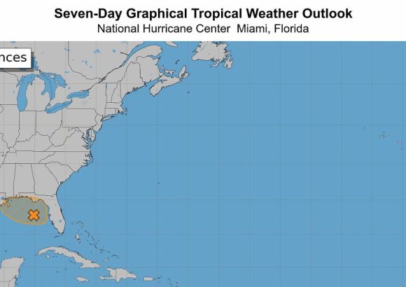
The Dominican Institute of Meteorology (Indomet) announced on Sunday that it has launched continuous monitoring activities for an active weather system bringing heavy downpours and thunderstorms. The system is linked to a low-pressure trough positioned across the northern segment of the Gulf of Mexico, in close proximity to the U.S. state of Florida.
Meteorological analysts from Indomet have assessed that this disturbance carries a 60% medium likelihood of organizing into a cyclonic system within the next two days. This same 60% probability projection also holds for cyclone development over the full seven-day forecast window, per the agency’s official statement.
Crucially, Indomet has clarified that the system does not pose any immediate danger to the Dominican Republic. The current geographic position of the weather disturbance, its substantial distance from Dominican territory, and the projected path it is expected to follow all rule out imminent risk to the country, the institute confirmed.
Indomet has emphasized that it will maintain round-the-clock surveillance of the system’s progression, and pledged to promptly issue public updates if any material shifts occur in the system’s strength, structure or projected trajectory.
This report draws on the latest updates published via DominicanScope, a leading platform for news from the Dominican Republic.