A moderate preliminary earthquake with a magnitude of 3.9 has been recorded in the northeastern Caribbean Sea early Tuesday, according to the Seismic Research Centre (SRC) based at The University of the West Indies.
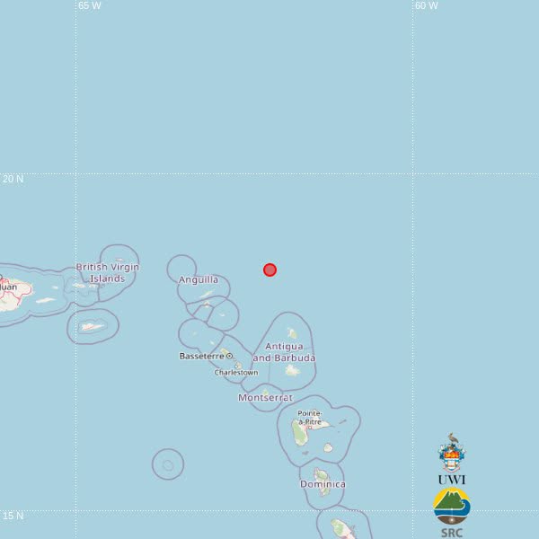
The seismic event struck at 10:37 a.m. local time, which corresponds to 14:37 UTC, and was estimated to have originated at a depth of 10 kilometers below the sea floor. The epicenter of the tremor was pinned at geographic coordinates 18.58 degrees north latitude and 62.13 degrees west longitude. This positioning places it roughly 157 kilometers northeast of Basseterre, the capital of Saint Kitts and Nevis, 166 kilometers north-northwest of St John’s, the capital of Antigua and Barbuda, and 198 kilometers north of Brades, the administrative center of Montserrat.
In an official update, the SRC clarified that the initial magnitude and location data for the earthquake were generated automatically through computer processing algorithms, meaning all current readings remain preliminary. The institution added that seismologists on its team will conduct a follow-up detailed analysis, and the published information may be adjusted once the review process is complete.
As of the latest update, no immediate reports of structural damage or casualties linked to the tremor have been received. It also remains unconfirmed whether the shaking was perceptible to residents on the nearby Caribbean islands.