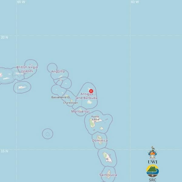
A light 3.6-magnitude earthquake has been confirmed in waters northeast of Antigua by the University of the West Indies Seismic Research Centre (UWI SRC), the region’s leading authority on seismic activity, in a statement released over the weekend.
According to the UWI SRC’s initial monitoring data, the tremor struck at roughly 9:10 p.m. local time on Friday, registering a depth of 14 kilometres beneath the ocean surface. Preliminary geolocation calculations place the epicenter at coordinates 17.57 degrees north latitude and 61.73 degrees west longitude.
This positioning puts the earthquake approximately 52 kilometres north-northeast of St. John’s, the capital city of Antigua and Barbuda. Beyond Antigua’s territorial waters, the epicenter also sits 101 kilometres northeast of Brades, the administrative center of Montserrat, and 115 kilometres east-northeast of Basseterre, the capital of St. Kitts and Nevis.
The UWI SRC emphasized that the current epicenter location was generated automatically by pre-programmed computer processing algorithms. Before final data is published, the location and other key parameters of the earthquake will undergo manual review and potential adjustment by the center’s team of expert seismologists as part of standard quality control processes.