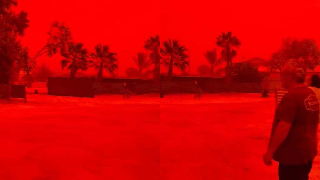
Western Australia witnessed an extraordinary meteorological spectacle over the weekend as Tropical Cyclone Narelle generated a massive dust storm that plunged entire regions into an eerie blood-red darkness. The phenomenon created surreal visuals across Shark Bay and Denham, where daytime skies turned deep crimson, capturing global attention through viral social media dissemination.
Scientific analysis confirms the extraordinary coloration resulted from specific atmospheric optics. High-density dust particles scattered shorter blue light wavelengths, permitting only longer red wavelengths to penetrate the atmosphere. This Rayleigh scattering effect, amplified by cyclonic conditions, produced the intense reddish hue that many observers initially mistook for digital manipulation.
While the visual phenomenon fascinated scientists and social media users alike, Cyclone Narelle established itself as a historically significant weather event. Marking the first cross-jurisdictional landfall in over two decades, the storm system initially struck Queensland’s Cape York Peninsula on March 20 before traversing the Northern Territory and intensifying over the Indian Ocean. The cyclone ultimately reached Western Australia as a Category 4 system, causing substantial damage across affected regions.
The viral documentation of this event has sparked both scientific discourse and public amazement, highlighting nature’s capacity for producing breathtaking visual phenomena alongside destructive meteorological forces.