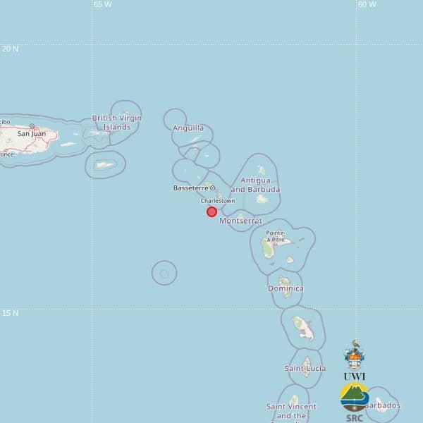
A moderate seismic event measuring 4.0 on the Richter scale was detected in the Eastern Caribbean region earlier today, as confirmed by the Seismic Research Centre (SRC) at The University of the West Indies. The tremor occurred precisely at 1:24 p.m. local time (17:24 UTC) on Saturday, with preliminary coordinates placing the epicenter at latitude 16.85N and longitude 62.74W.
The seismic activity originated at a relatively shallow depth of approximately 10 kilometers beneath the Earth’s surface. Geographical positioning data indicates the quake was situated approximately 49 kilometers south of Basseterre, St Kitts and Nevis; 59 kilometers west of Brades, Montserrat; and 103 kilometers west-southwest of St John’s, Antigua and Barbuda.
Initial assessments from regional authorities indicate no immediate reports of structural damage, injuries, or casualties resulting from the seismic activity. The SRC has emphasized that their preliminary location data was automatically generated through advanced computer algorithms and may undergo refinement following comprehensive analysis by seismic experts.
This event occurs within the geologically dynamic Lesser Antilles arc, a region known for significant tectonic activity. The area represents a convergent boundary where the Caribbean and North American tectonic plates interact, creating a seismically active zone that regularly produces earthquakes across varying magnitude levels. The region’s complex geological framework continues to be closely monitored by seismic research organizations.