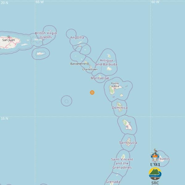
A minor seismic event registering 3.7 magnitude occurred in the Eastern Caribbean basin on Monday afternoon, as detected by the automated monitoring systems of the University of the West Indies Seismic Research Centre (UWI-SRC). The tremor was recorded at precisely 12:32 local time (16:32 GMT), with its seismic epicenter positioned at geographical coordinates 16.05°N latitude and 62.51°W longitude. The quake originated at an intermediate depth of 53 kilometers beneath the Caribbean Sea floor. According to seismic mapping data, the epicentral region was located approximately 88 kilometers southwest of Brades, Montserrat; 110 kilometers west-southwest of Point-à-Pitre, Guadeloupe; and 138 kilometers southwest of St. John’s, Antigua and Barbuda. Initial assessments indicate no immediate reports of structural damage, injuries, or tsunami alerts following the event. The UWI-SRC emphasized that their preliminary report was automatically generated by their seismic monitoring network and remains subject to potential revision once seismologists conduct comprehensive manual analysis. The Eastern Caribbean region resides within an active seismic zone characterized by complex tectonic interactions between the Caribbean and North American plates, making such minor tremors relatively frequent geological occurrences.