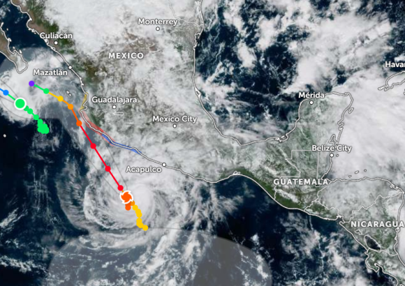
On Friday, Hurricane Trudy underwent rapid intensification, upgrading to a powerful Category 3 major hurricane that is on track to approach Mexico’s southwestern and west-central Pacific coastline over the weekend. Meteorological experts have issued urgent warnings about the life-threatening hazards the storm is expected to bring, including extreme rainfall, flash flooding, and destructive landslides across vulnerable coastal regions.
Data from the U.S. National Hurricane Center (NHC) shows that as of Friday morning, the storm packed maximum sustained winds of 120 miles per hour (195 kilometers per hour), with its central barometric pressure dropping to 956 millibars – a reading that confirms its status as a dangerous major hurricane. Trudy was tracking north-northwest at a steady forward speed of around 5 miles per hour (8 kilometers per hour), positioning its center roughly 235 miles (380 kilometers) southwest of the coastal city of Acapulco, and 325 miles (525 kilometers) south-southeast of Manzanillo.
Forecasters at the NHC project that Trudy will continue gaining additional strength through Saturday, and it is expected to maintain its major hurricane classification when it reaches its closest point to the Mexican coast. Currently, a formal hurricane warning is active for multiple stretches of Mexico’s Pacific coastline, with local emergency management authorities maintaining round-the-clock surveillance of the storm’s track and intensity as it creeps closer to shore.
The most up-to-date projection from weather modelers indicates that Trudy will pass extremely close to the Mexican coastline late Saturday. News agency Reuters reports that the storm’s center is forecast to come within 60 to 65 kilometers of the coastlines of the Mexican states of Jalisco and Colima. At this stage, meteorologists do not anticipate a full direct landfall, though the close proximity of the powerful storm still puts coastal communities at severe risk of major weather impacts.