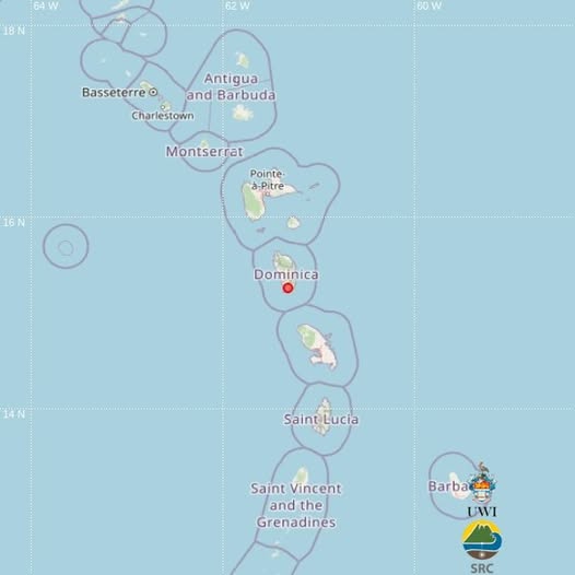
A light magnitude 3.2 earthquake shook areas near the Caribbean island nation of Dominica in the early hours of Friday, July 17, regional seismic monitors have confirmed. According to the University of the West Indies Seismic Research Centre (UWI SRC), the tremor hit at 4:51 a.m. local time, which translates to 08:51 UTC, with its epicenter tracked to coordinates 15.26°N latitude and 61.33°W longitude. The geological event originated at a particularly shallow depth of just 5 kilometers below the Earth’s surface.
Due to the quake’s proximity to populated areas and shallow subsurface origin, the tremor was detectable and felt by local residents. UWI SRC confirms that seismic technicians manually reviewed the event data to verify its location, magnitude, and depth before issuing the public notice. As of the latest updates from local authorities, there have been no immediate reports of structural damage, injuries, or casualties connected to the earthquake.
In a public call for citizen science participation, the UWI SRC is urging all Dominicans who felt the shaking to submit their personal observations via the center’s official felt report system. This crowdsourced data plays a critical role in helping seismologists refine their understanding of how the earthquake propagated through local geology and what impacts it had across different communities.
Geographically, Dominica sits within the highly seismically active eastern Caribbean zone, a region shaped by the constant movement and interaction of tectonic plates beneath the Atlantic Ocean and Caribbean Sea. This tectonic activity makes small, light earthquake events relatively common along the island chain, with most posing minimal risk to infrastructure or public safety.