Even as the Caribbean island nation of Barbados enters its annual wet and hurricane season, a long-running drought is projected to persist for months, with climate forecasters linking sustained dry conditions to El Niño-driven rainfall suppression that could stretch water scarcity into early 2025. In an official advisory released from the capital Bridgetown, the Barbados Meteorological Services (BMS) outlined that while the seasonal shift typically brings more regular showers and active thunderstorm activity, persistent El Niño conditions in the Pacific Ocean are drastically cutting into expected precipitation totals this year.
El Niño is a recurring climate pattern defined by above-average sea surface warming across the central and eastern Pacific. This oceanic shift reshapes global atmospheric circulation, often weakening the moisture-laden weather systems that ordinarily deliver consistent rainfall to Caribbean island nations.
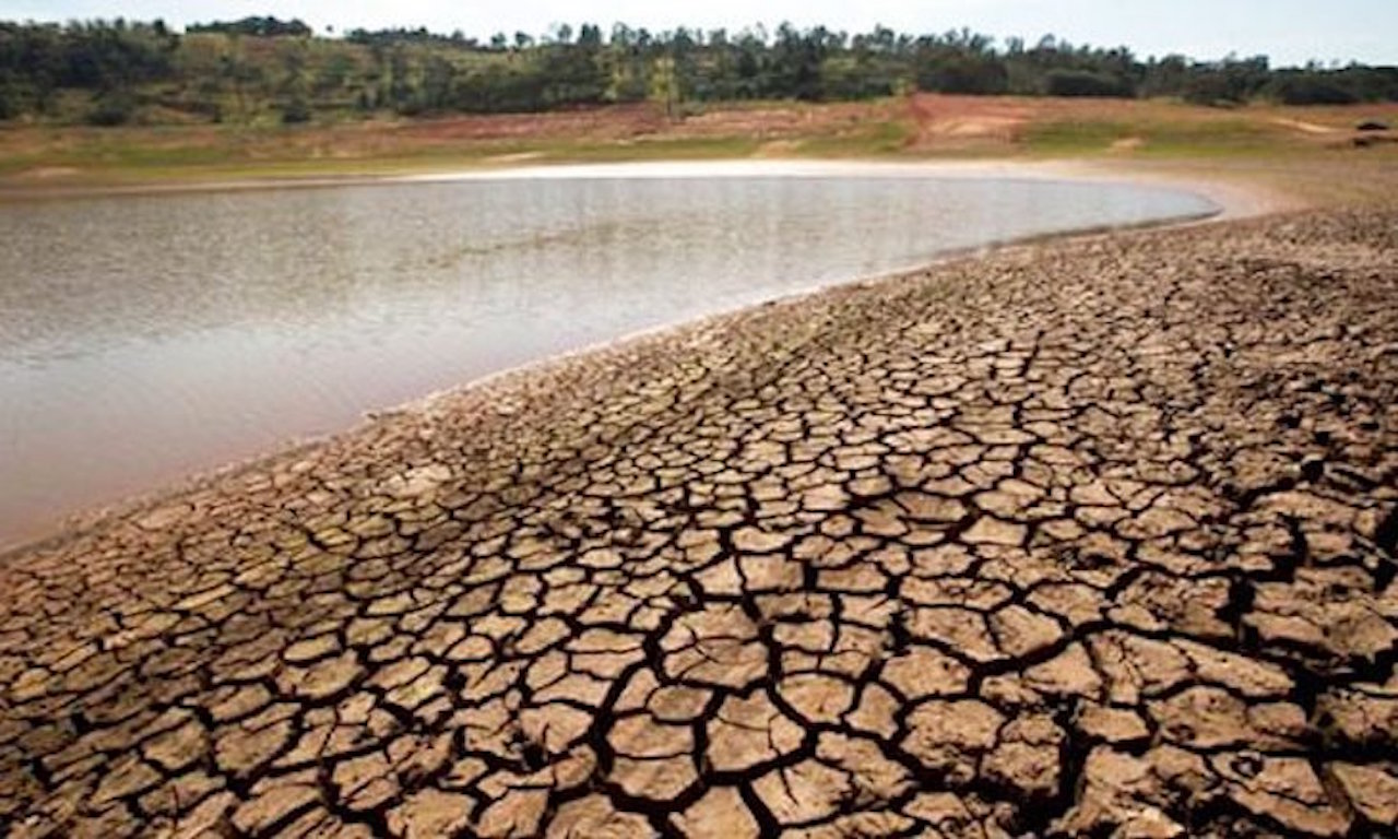
For Barbados, which marked the start of its wet season two weeks ago, this translates to far fewer, less sustained rain events, raising the odds of prolonged dry spells and deepening drought even in the wettest part of the year. BMS data shows total rainfall recorded through the end of May hit 278.4 millimeters, near the island’s historical average, but more than 70 percent of that total fell across just a handful of days in January and March, creating extreme uneven distribution of precipitation.
This patchy rainfall has left vegetation severely stressed, especially in the southern and southwestern regions of the small island. While a handful of tropical waves have passed through the region in recent weeks, they have only delivered minimal, short-term relief from the ongoing dry conditions. Looking ahead to the next three to five months, BMS experts project rainfall will stay at or below historical averages through October, with El Niño forecast to strengthen over that period— a shift that carries a 75 percent probability of occurring, according to current climate models.
Forecasters caution that while isolated, intense downpours may trigger temporary localized flooding in low-lying parts of the island, these brief bursts of rain do not effectively recharge Barbados’ critical freshwater aquifers. Those underground water reserves require slow, sustained rainfall to replenish, meaning even occasional heavy storms will not resolve the underlying water scarcity.
Compounding the island’s water challenges, Barbados has also entered its annual heat season. While forecasters do not expect temperatures to surpass the record highs set in 2023 and 2024, with moderate relief from consistent brisk trade winds, above-average air and sea surface temperatures are still locked in for the coming months. This combination of heat and dryness creates elevated heat stress risk for outdoor workers, children, older adults, and vulnerable people living with chronic health conditions, particularly on increasingly humid days and warm nights when overnight cooling is limited.
Under the current outlook, BMS plans to elevate official drought alert levels through October: formal drought warnings will remain in place for June and July, followed by drought watches from August through the end of October. BMS officials also warn that the convergence of above-average temperatures, below-normal rainfall, and strong winds through this wet season could set the stage for an unusually dry start to 2025, meaning new drought warnings may be issued before the end of 2024.