On the morning of Monday, June 8, 2026, a massive 7.8-magnitude earthquake hit the southern region of the Philippines, triggering a humanitarian emergency that has claimed at least 35 lives and left more than 200 people injured across Mindanao. According to data from the United States Geological Survey (USGS), the seismic event occurred around 7:37 a.m. local time, with an epicenter located off the coast of General Santos City in Sarangani Province, at a depth of 35 kilometers below the Earth’s surface.
Local disaster management authorities confirmed that 13 of the confirmed fatalities were caused by a large landslide in Sarangani that was directly triggered by the strong tremor. As of the latest updates, emergency rescue teams are still methodically searching through collapsed and damaged structures, with full-scale response operations continuing around the clock to locate missing survivors and deliver critical aid to affected communities.
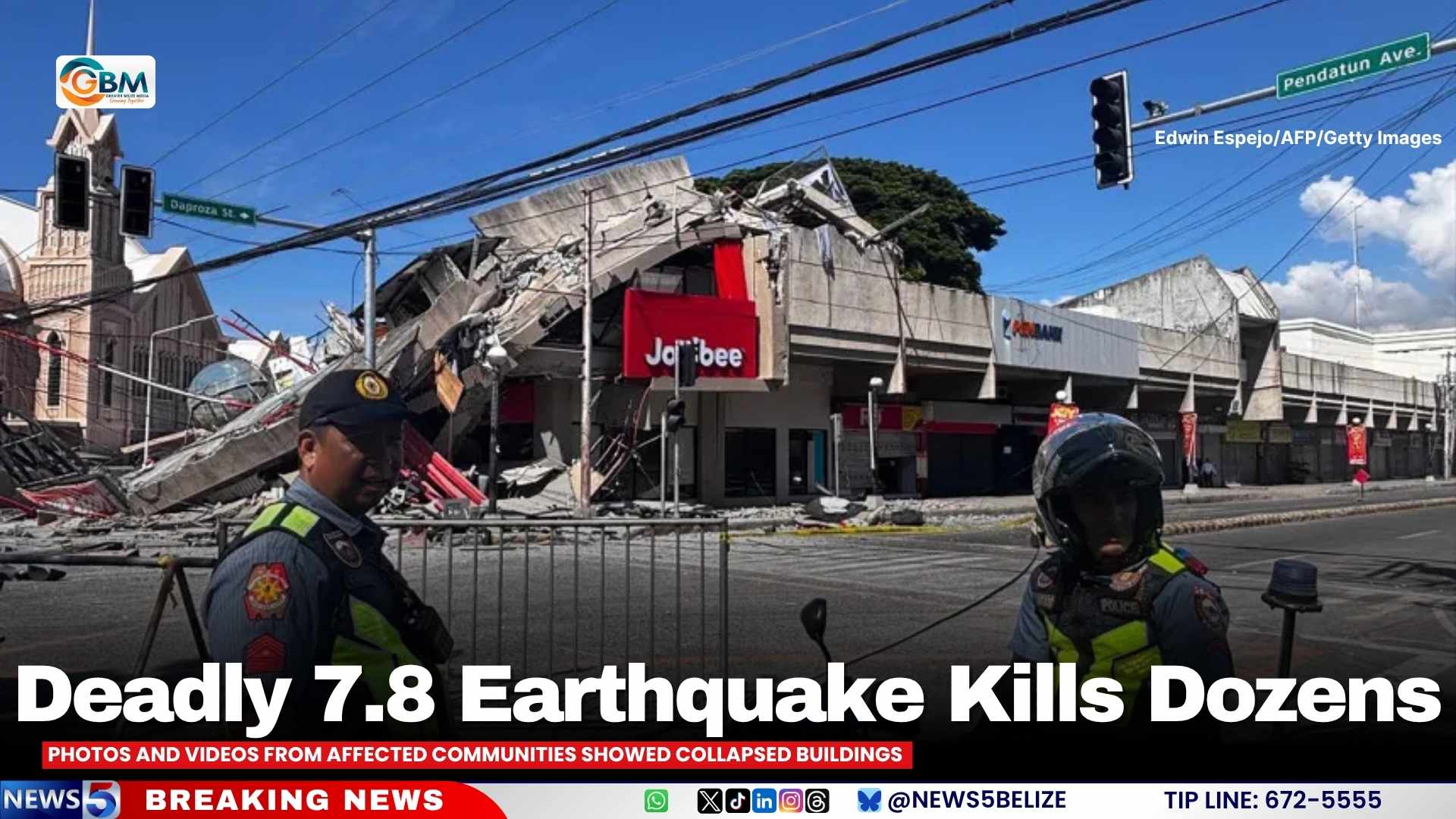
Visual content shared by local residents and journalists paints a grim picture of the destruction: multi-story buildings have partially or fully collapsed, local commercial establishments have sustained severe structural damage, and thousands of frightened residents fled their homes and workplaces to gather in open, safe spaces. In General Santos City, one of the hardest-hit urban centers, a popular fast-food outlet partially caved in during the tremor, and dozens of other commercial buildings across the city report significant structural damage that will require extensive repairs.
A particularly chaotic element of the disaster is its timing: the earthquake struck on the first day of the country’s new academic year, sparking panic across hundreds of schools in the affected region. Viral videos circulating on social media platforms show children and young students diving under desks and scrambling for safety as classroom walls and school grounds shook violently for the duration of the tremor. No school-related fatalities have been reported as of yet, though multiple schools sustained damage that will force extended closures.
Shortly after the seismic event, Philippine President Ferdinand Marcos Jr. issued an executive order directing all relevant government agencies to launch immediate evacuation and rescue operations. He also issued a formal warning to residents living in low-lying coastal areas, urging them to comply with official tsunami advisories and evacuate immediately to higher ground to avoid potential secondary hazards.
Geographically, the Philippines sits along the Pacific Ring of Fire, a 40,000-kilometer horseshoe-shaped zone marked by intense tectonic activity that is home to 75 percent of the world’s active volcanoes and experiences 90 percent of the planet’s earthquakes. This location means the archipelago nation faces regular seismic threats, with large destructive earthquakes impacting populated areas on a semi-regular basis.