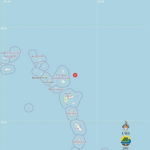
A moderate 4.3-magnitude earthquake has been detected in waters northeast of the Caribbean nation Antigua and Barbuda, according to an initial automatic alert released by the University of the West Indies Seismic Research Centre.
The seismic event unfolded around 9:41 p.m. local time Tuesday, which translates to 01:41 UTC on Wednesday, per the center’s preliminary assessment. Geospatial data pins the earthquake’s coordinates at 17.44 degrees north latitude and 61.18 degrees west longitude, with the hypocenter sitting roughly 39 kilometers below the ocean floor.
Calculations place the epicenter approximately 82 kilometers northeast of St. John’s, Antigua and Barbuda’s capital, 135 kilometers northeast of Brades, the administrative center of Montserrat, and 138 kilometers north-northeast of Point-à-Pitre, the largest city on the French Caribbean island of Guadeloupe.
In the immediate hours after the tremor was recorded, no reports of structural damage or human harm have emerged across the region. The Seismic Research Centre has emphasized that the current geographic and magnitude data is fully automated, generated by computer processing algorithms. Officials noted that final parameters will be updated after manual review and further analysis by the center’s team of professional seismologists.