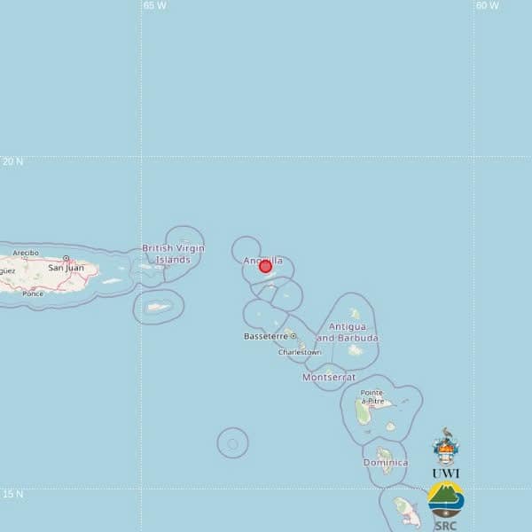
A minor earthquake measuring magnitude 3.9 has been registered in waters north of the Caribbean nation of Antigua and Barbuda, according to the University of the West Indies (UWI) Seismic Research Centre.
The seismic event struck at 4:12 p.m. local time on Sunday, with a calculated depth of 28 kilometers below the ocean surface. Geographical data pinpoints the epicenter at coordinates 18.35 degrees north latitude and 63.13 degrees west longitude, placing it around 198 kilometers northwest of St. John’s, Antigua and Barbuda’s capital. The epicenter is also situated roughly 124 kilometers north-northwest of Basseterre, the capital of St. Kitts and Nevis, and approximately 200 kilometers northwest of Brades, the administrative center of Montserrat. All measurements confirm the quake struck a significant distance from any populated landmass, in open offshore waters.
As of the first official updates, there have been no public reports that the tremor was felt by residents across Antigua and Barbuda, nor have any casualties or structural damage been linked to the event.
The UWI Seismic Research Centre has cautioned that the current magnitude and epicenter location data was produced automatically by computer algorithms. The readings are classified as preliminary, and will undergo further evaluation and adjustment if needed by the center’s team of seismic analysts before final confirmation.