In the Dominican Republic’s capital of Santo Domingo, national emergency officials have broadened a green weather alert to cover five inland provinces and the country’s National District, responding to an unstable weather trough that is disrupting atmospheric conditions across the entire island nation.
Data collected from satellite monitoring systems and ground-based weather radar confirms that the system has driven a sharp increase in cloud formation across the affected regions. This buildup of cloud cover is expected to produce moderate to intense rainfall through the coming days, paired with scattered isolated thunderstorms and sudden gusty winds that could create hazardous conditions for local communities.
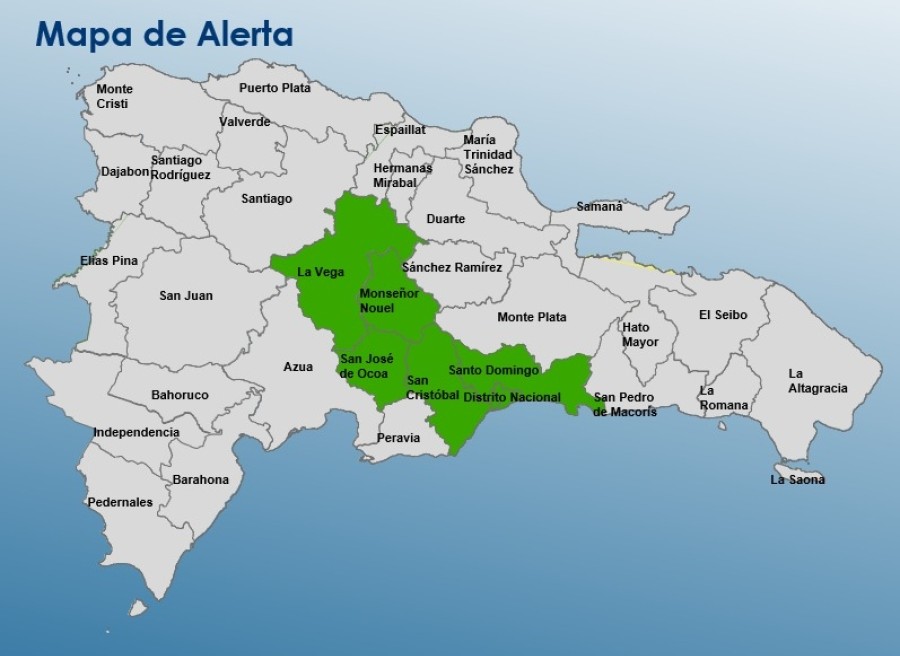
The areas officially placed under the expanded green alert are the province of Santo Domingo, the National District, San Cristóbal, Monseñor Nouel, La Vega, and San José de Ocoa. Green alerts, the lowest tier of weather warnings in the Dominican Republic’s emergency system, are issued to inform the public of developing dangerous conditions that require heightened awareness and preparation.
Emergency management authorities have issued clear guidance for residents in all affected zones to mitigate risk. The public has been strongly advised against attempting to cross swollen rivers, fast-flowing streams, and rain-swollen ravines, as rising water levels can create sudden life-threatening hazards. Additionally, residents and visitors have been instructed to avoid all recreational water sites, including beaches and inland swimming spots, across the warning areas until conditions improve.
Along the Dominican Republic’s Atlantic coastline, stretching from the eastern edge of Saona Island northward to Monte Cristi, additional precautions are in place for maritime traffic. Operators of small, structurally less sturdy vessels have been told to keep their boats docked in port, as sustained strong winds and choppy, dangerous wave conditions put small craft at high risk of capsizing or distress.