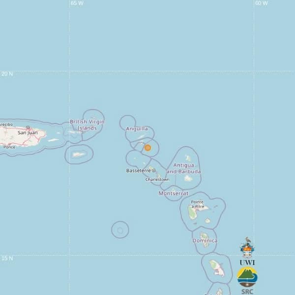
A moderate seismic event measuring 3.5 on the Richter scale was detected in the Caribbean Sea on Monday afternoon, as reported by the University of the West Indies Seismic Research Centre (UWI-SRC). The tremor occurred precisely at 2:07 p.m. local time (18:07 UTC), with its epicenter positioned approximately 146 kilometers northwest of St. John’s, Antigua and Barbuda.
The earthquake’s hypocentral depth was recorded at 55 kilometers beneath the Earth’s surface, with precise coordinates placing it at latitude 17.92° north and longitude 62.89° west. According to seismic mapping data, the epicenter was additionally located 71 kilometers north-northwest of Basseterre, St. Kitts and Nevis, and 146 kilometers northwest of Brades, Montserrat.
UWI-SRC officials emphasized that the preliminary location data was automatically generated through advanced computer algorithms and remains subject to potential revision following comprehensive expert analysis. The research center maintains standard protocols for verifying all automatically processed seismic information through manual review processes.
Initial assessments from regional authorities indicate no immediate reports of structural damage, injuries, or significant impact on infrastructure across affected areas. The earthquake’s considerable depth likely contributed to minimized surface effects throughout the northeastern Caribbean region. Seismologists continue to monitor aftershock potential while confirming this event represents routine seismic activity within the geologically active Caribbean plate boundary system.