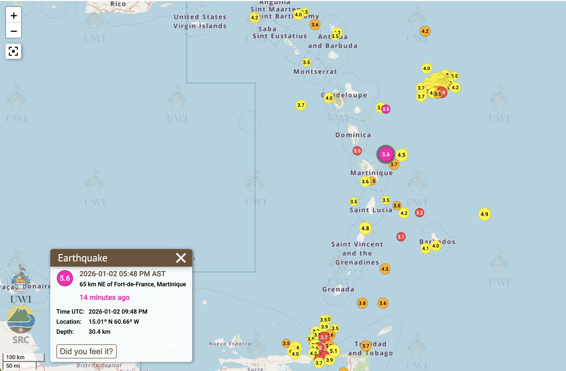
The Eastern Caribbean region experienced significant seismic activity as a substantial earthquake measuring 5.6 in magnitude struck near Saint Lucia on Friday, January 2nd. The tremor occurred at precisely 5:38 p.m. local time, registering at a considerable depth of 30.4 kilometers beneath the Earth’s surface, according to preliminary data released by the University of the West Indies’ Seismic Research Centre.
The seismic event’s epicenter was pinpointed approximately 65 kilometers northeast of Fort-de-France, Martinique, indicating a substantial tectonic disturbance in the region. The quake’s effects were widely reported across multiple population centers including Ciceron, Castries, and Gros Islet, where residents experienced noticeable shaking and vibration.
This significant seismic event follows closely on the heels of a smaller 3.5-magnitude earthquake that occurred off the coast of Guadeloupe in the early hours of New Year’s Day, just after midnight. The consecutive seismic activities have raised attention to the heightened tectonic movements currently affecting the Caribbean region, known for its complex geological structure along multiple fault lines.
Seismologists are continuing to monitor the situation for potential aftershocks and are analyzing data to better understand the implications of these back-to-back seismic events. The Caribbean region, situated along the boundary of the Caribbean and North American tectonic plates, frequently experiences such seismic activity, though earthquakes of this magnitude warrant particular attention from both scientists and emergency preparedness officials.