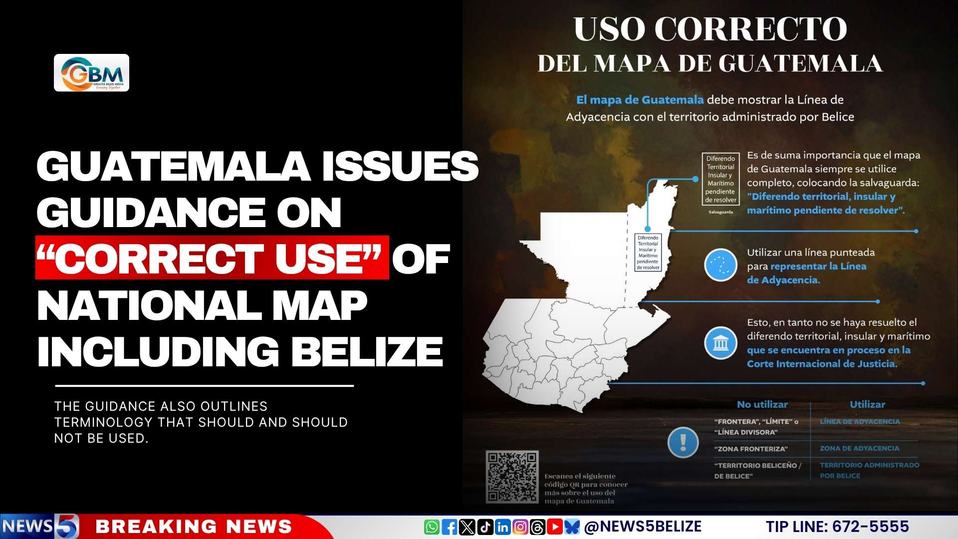
In a significant move addressing a long-standing territorial dispute, Guatemala’s Ministry of Foreign Affairs has issued official guidelines on the ‘correct use’ of the national map, particularly in relation to Belize. The guidelines emphasize the representation of the Adjacency Line, which separates Guatemala from the territory currently administered by Belize, while the dispute remains unresolved at the International Court of Justice (ICJ).
The ministry mandates that all official maps must include the Adjacency Line, represented by a dotted line, accompanied by a safeguard note stating: ‘Diferendo territorial, insular y marítimo pendiente de resolver’ (‘Territorial, insular, and maritime dispute pending resolution’). This measure underscores the ongoing nature of the dispute and the need for accurate representation.
Furthermore, the guidelines specify the terminology to be used, prohibiting terms such as ‘border,’ ‘limit,’ ‘dividing line,’ ‘border zone,’ and ‘Belizean territory.’ Instead, the ministry instructs the use of ‘Línea de Adyacencia’ (Adjacency Line), ‘Zona de Adyacencia’ (Adjacency Zone), and ‘territorio administrado por Belice’ (territory administered by Belize). These directives aim to maintain clarity and neutrality in official communications.
The issuance of these guidelines reflects Guatemala’s commitment to formalizing its stance on the territorial dispute while awaiting the ICJ’s resolution. The move is expected to influence public and institutional practices, ensuring consistency in how the national map is portrayed.