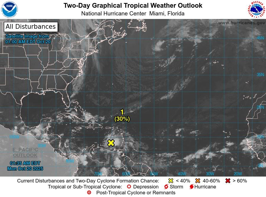
A significant tropical wave is currently active over the eastern Caribbean Sea, situated a few hundred miles west of the Windward Islands. This weather system is generating widespread but disorganized showers and thunderstorms. Satellite data reveals that the disturbance lacks a closed circulation, though it is producing winds of 30 to 40 mph to the north and east of its axis. Moving swiftly westward at 20 to 25 mph, the wave is expected to limit significant development in the immediate future. However, as it slows over the central Caribbean Sea later this week, environmental conditions are predicted to become more favorable, increasing the likelihood of a tropical depression forming. Regardless of development, heavy rainfall and gusty winds are anticipated to persist across the Windward and Leeward Islands. The probability of formation within the next 48 hours is low at 30%, but it rises to 70% over the next seven days. Additionally, another tropical wave in the central Atlantic, with its axis near 45°W, is moving westward at 10-15 kt, accompanied by scattered moderate convection. Flash flood and landslide advisories are currently in effect, and the next update will be issued at 8 am by the Meteorological Services of the Grenada Airports Authority.