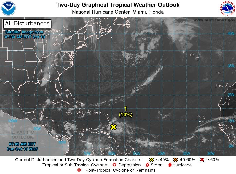
The Tropical North Atlantic Ocean, Caribbean Sea, and Gulf of Mexico are under close surveillance as two tropical waves pose significant weather threats to the region. Tropical Wave 1, currently positioned near 64°W south of 17°N, is advancing westward at 15 to 20 knots. Scattered moderate convection has been observed south of 14°N between 62°W and 65°W. Meanwhile, Tropical Wave 2, identified as Invest AL98, is located near 57°W, approximately 270 nautical miles east of Grenada, stretching from 04°N to 18°N. This system is moving westward at 20 knots, generating widespread showers and thunderstorms. Heavy rainfall and gusty winds are anticipated across the Windward and Leeward Islands, persisting through Monday morning. The wave is expected to accelerate into the eastern Caribbean Sea at 20 to 25 mph. While further development is limited in the next 48 hours due to its rapid movement, conditions may become more favorable for intensification as it slows over the central Caribbean Sea later this week. A tropical depression could form by mid to late week, with a 10% chance of development within 48 hours and a 60% chance over seven days. Grenada remains under a flash flood and landslide advisory as the axis of the wave is projected to traverse the island this afternoon. Updates will be provided at 2 pm by the Meteorological Services of the Grenada Airports Authority (GAA).