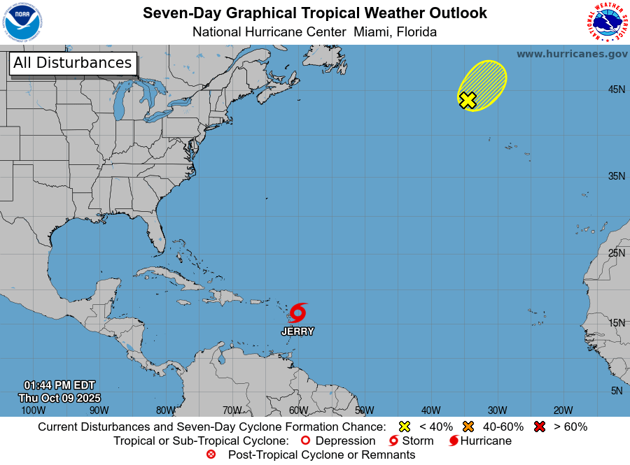
A tropical storm warning has been activated for the Northern Leeward Islands as Tropical Storm Jerry advances toward the region. The National Hurricane Center (NHC) has alerted residents to brace for strong winds, torrential rainfall, and hazardous marine conditions, expected to intensify later this evening and persist into the night. Jerry is projected to pass near or just north of the Leeward Islands within the next few hours, with maximum sustained winds recorded at approximately 65 mph (100 km/h) and potential gusts reaching higher speeds. At the latest advisory, the storm’s center was located about 200 miles east of Antigua, moving west-northwest at 17 mph (28 km/h). Authorities in Antigua and Barbuda, St Kitts and Nevis, Anguilla, and neighboring islands have issued urgent calls for residents to prepare for tropical storm conditions, which could trigger flash flooding in low-lying areas and create perilous coastal conditions. The NHC forecasts that tropical storm-force winds and heavy rainfall will impact the warning zones through early Friday, accompanied by dangerous surf and rip currents. While Jerry may experience slight strengthening in the short term, meteorologists predict less favorable conditions over the weekend. Residents are strongly advised to stay updated through official channels and adhere to guidance from local disaster management authorities.