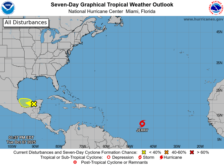
Tropical Storm Jerry is rapidly advancing west-northwest, with the U.S. National Hurricane Center (NHC) closely monitoring its trajectory. As of 8 a.m. AST on Wednesday, the storm’s center was positioned near latitude 13.3 North and longitude 51.6 West, approximately 835 miles east-southeast of the northern Leeward Islands. Jerry is moving at 23 mph, with maximum sustained winds nearing 50 mph and a minimum central pressure of 1003 millibars. A Tropical Storm Watch has been issued for multiple islands, including Antigua, Barbuda, Anguilla, St. Kitts, Nevis, Montserrat, St. Barthelemy, St. Martin, Sint Maarten, Saba, St. Eustatius, Guadeloupe, and adjacent islands. Forecasters predict Jerry will strengthen into a hurricane by Thursday, with its core passing near or north of the northern Leeward Islands late Thursday into Friday. Tropical-storm-force winds extend up to 125 miles from the center, and rainfall totals of 2 to 4 inches could trigger flash flooding, particularly in elevated areas. Swells generated by Jerry are expected to reach the Leeward and Windward Islands by Thursday, potentially causing life-threatening surf and rip current conditions. Residents are urged to stay updated through their national meteorological services and adhere to official guidance. The NHC will issue its next full advisory at 11 a.m. AST.
Tropical Storm Jerry Strengthens as It Moves Toward the Leeward Islands