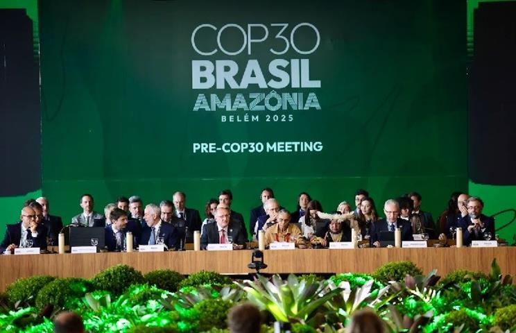
As the 30th United Nations Climate Change Conference (COP30) commenced this Monday, ministers are grappling with a deadlock on some of the most contentious issues. Despite Brazil’s role as host and its emphasis on member-driven decision-making, critical topics such as climate finance for the Global South and updated emissions reduction targets remain excluded from the formal agenda. Andre Correa do Lago, COP30 President, reiterated that decisions are made ‘from the bottom up,’ underscoring the collaborative nature of the process. To prevent the conference from stalling, Brazil has appointed foreign ministers as facilitators for complex discussions on finance, mitigation, just transition, and the ‘global stocktake’—a mechanism evaluating compliance with the Paris Agreement. The first week saw significant pledges from the private sector, with investments reportedly reaching ‘trillions of dollars,’ according to the UN. However, developing nations argue that relying primarily on private capital is insufficient. They demand that the $300 billion annual target set at COP29 be funded predominantly by public sources, with aspirations to escalate this figure to $1.3 trillion. In response, the presidencies of COP29 and COP30 have proposed exploring global taxes on key sectors. Yet, Brazil has acknowledged the lack of consensus, suggesting that any meaningful progress may not materialize until after 2026.
分类: world
-

More than 800 Cambodian families displaced by border incident
In the wake of a violent incident near the Cambodia-Thailand border, local authorities and humanitarian donors have stepped in to assist hundreds of residents who sought refuge at the Wat Chan Sy Samaky Ratanaram sanctuary. The shooting, which occurred in the village of Prey Chan, resulted in one fatality and left three individuals seriously injured. Despite no further armed clashes reported on November 13 and 14, authorities have maintained a heightened state of alert in the affected areas of Prey Chan and Chouk Chey, as confirmed by the Cambodian news agency AKP. Oum Reatrey, the provincial governor of Banteay Meanchey, emphasized the government’s commitment to protecting its citizens, stating, ‘The Royal Government will not allow any citizen to be in a vulnerable situation during this difficult time.’ Meanwhile, Sophea Eat, the Permanent Secretary of State at the Ministry of Foreign Affairs and International Cooperation, briefed the diplomatic corps and international organizations on the recent border tensions. She disclosed that Cambodia had formally protested the shooting by Thai forces on November 12, highlighting that the unauthorized use of force has disrupted the ongoing border demarcation efforts agreed upon by both nations in October.
-
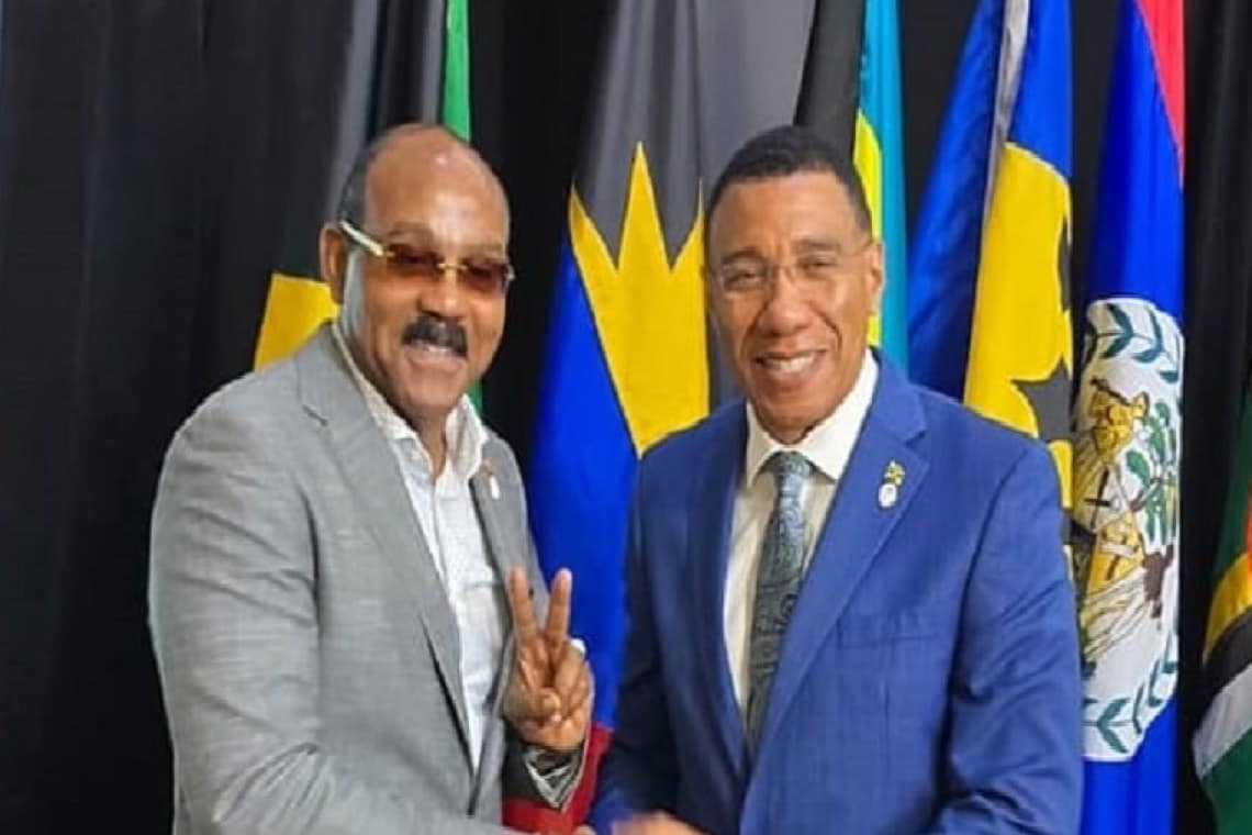
Prime Minister Gaston Browne joins CARICOM Solidarity Mission to Jamaica after Hurricane Melissa
On November 16, 2025, Prime Minister Gaston Browne of Antigua and Barbuda, accompanied by his wife and Minister Maria Browne, will lead a CARICOM delegation to Jamaica to express solidarity with the nation following the catastrophic impact of Hurricane Melissa. The delegation, set to depart on Monday morning, will focus on Montego Bay and surrounding communities in St. James, areas severely affected by the Category 5 storm. The visit aims to assess recovery efforts, support regional coordination, and meet with Jamaican Prime Minister Andrew Holness and local leaders. Prime Minister Browne emphasized the importance of collective action, stating, ‘As CARICOM brothers and sisters, we cannot stand by when one of our own is suffering. Jamaica has endured an unimaginable blow, and we must rally around its people — not just in messages of comfort, but with action, coordinated support, and a shared commitment to rebuild.’ Minister Maria Browne also expressed her sorrow and hope for renewal and unity in the Caribbean. Hurricane Melissa, which made landfall on October 28, 2025, caused widespread devastation, including 28 fatalities, severe infrastructure damage, and economic losses estimated at US$6-7 billion, or 28-32% of Jamaica’s GDP. Recovery efforts are ongoing, but challenges such as blocked roads, fallen power lines, and massive debris remain. Regional organizations like the Caribbean Disaster Emergency Management Agency (CDEMA) and the Caribbean Public Health Agency (CARPHA) have mobilized swiftly to provide aid and coordinate recovery. The CARICOM delegation’s visit underscores the region’s unity and commitment to long-term reconstruction and climate resilience. Prime Minister Browne called for regional and international support to rebuild stronger and smarter, emphasizing that ‘climate change is not coming, it is already here.’ The mission highlights CARICOM’s leadership and solidarity in the face of disaster, reaffirming that when one Caribbean nation falters, the rest stand ready to help lift it up.
-
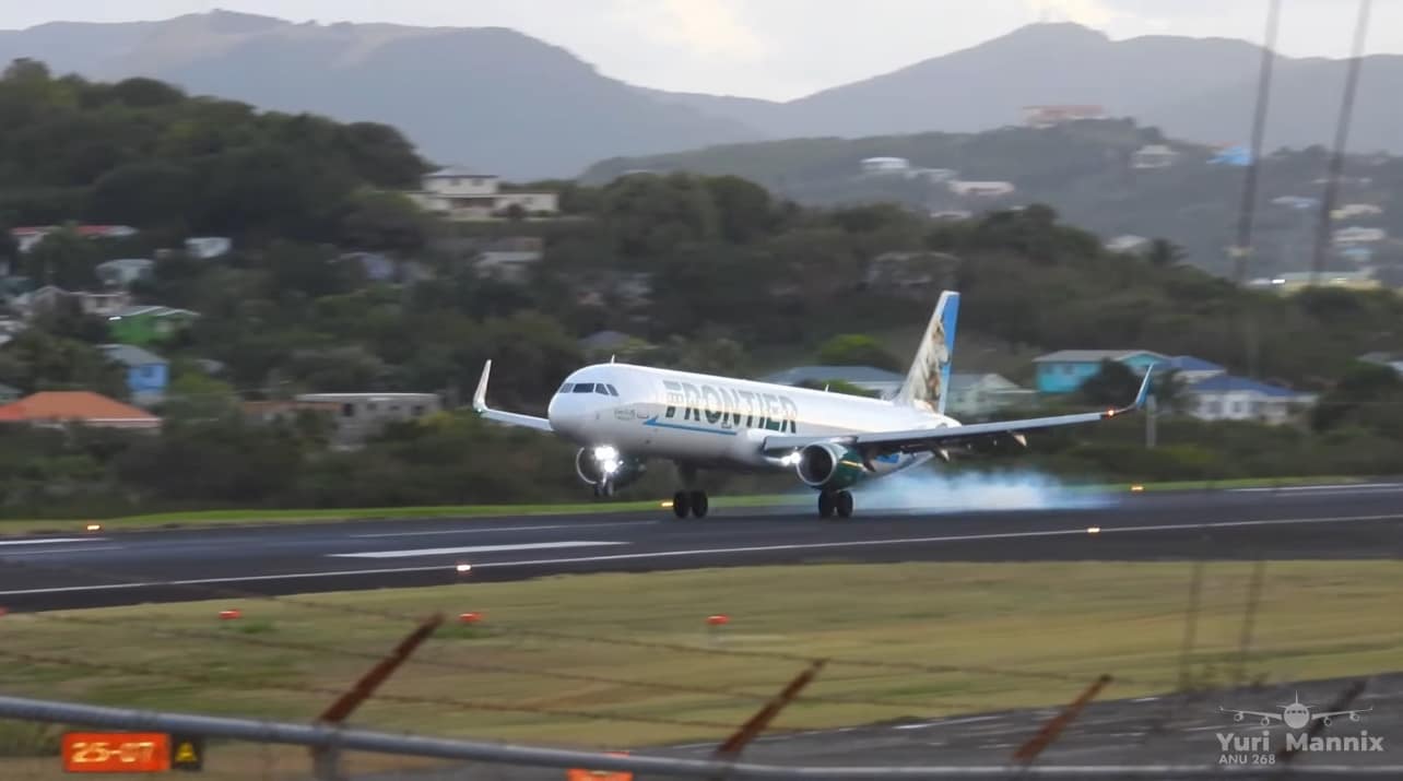
ECCAA Says Process Toward Category One Restoration Now Advancing
The Eastern Caribbean Civil Aviation Authority (ECCAA) is making steady progress in its efforts to reclaim the region’s coveted Category One aviation rating. ECCAA Director-General Anthony Whittier has confirmed that ongoing coordination with U.S. authorities is a critical component of this process. While the recent U.S. government shutdown temporarily disrupted scheduled meetings, Whittier assured stakeholders that full engagement will resume once federal operations are restored. Speaking at ECCAA’s legal seminar on Thursday, Whittier outlined the next steps, which include a preliminary on-site visit by the Federal Aviation Administration (FAA) technical team, followed by a formal assessment to determine the region’s eligibility for the top-tier rating. Whittier emphasized that ECCAA has successfully completed all major regulatory reforms required by the FAA, including updates to aviation safety management and operational practices. These reforms are pivotal to the FAA’s evaluation process. With the regulatory phase now concluded, ECCAA awaits the FAA’s confirmation of the preliminary visit, marking a significant milestone in the journey toward regaining Category One status.
-

Barbecue warns Haitians to remain indoors as gangs prepare for confrontation
Port-au-Prince, Haiti – Jimmy Cherizier, a prominent Haitian gang leader commonly referred to as “Barbecue” and spokesperson for the Viv Ansanm armed coalition, has called on citizens to remain indoors starting Monday. This plea comes as gangs prepare to confront law enforcement in what is expected to be a violent escalation. In a social media message, Cherizier urged transport unions, drivers, and families to stay home, emphasizing that the warning aims to prevent civilian casualties during the impending clashes. He also cautioned parents to keep children indoors, stating that gangs would not be accountable for those who disregard the alert.
This development follows a significant joint operation by the Haitian National Police, the Armed Forces, and the Gang Repression Force targeting the 400 Mawozo gang, which has long dominated areas north of Port-au-Prince. Authorities reported several gang members killed or injured, alongside the seizure of weapons, including a Barrett rifle and heavy machinery used to destroy public infrastructure. The operation marks a renewed effort by Haitian authorities to curb gang violence, which has plagued the nation for years.
The situation highlights the ongoing struggle between law enforcement and powerful criminal networks in Haiti, with civilians often caught in the crossfire. Cherizier’s warning underscores the precarious security environment and the challenges faced by the Haitian government in restoring order.
-
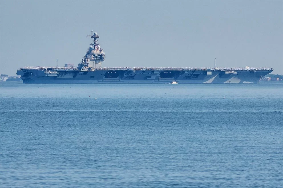
Amerikaans vliegdekschip arriveert in Caribisch gebied
The USS Gerald R. Ford, the United States’ most advanced aircraft carrier, arrived in the Caribbean Sea on Sunday, marking a significant demonstration of American military power. This deployment has sparked concerns about the Trump administration’s intentions in South America, particularly as the U.S. intensifies its military operations against vessels suspected of drug trafficking. The arrival of the Ford and other warships, announced by the Navy, underscores a pivotal moment in what the government terms an anti-drug operation but is widely perceived as escalating pressure on Venezuelan President Nicolás Maduro.
The Ford’s deployment completes the largest buildup of U.S. firepower in the region in decades. The mission, dubbed ‘Operation Southern Spear,’ now includes nearly twelve naval vessels and approximately 12,000 sailors and Marines. This move follows the military’s latest lethal strike on a small boat allegedly involved in transporting illegal drugs. A video released by the U.S. Southern Command on Sunday showed the boat being destroyed in international waters of the eastern Pacific, resulting in three fatalities. Since early September, such U.S. operations in the Caribbean and eastern Pacific have claimed at least 83 lives in 21 attacks.
Rear Admiral Paul Lanzilotta, commander of the strike group, emphasized that the deployment aims to ‘protect the safety and prosperity of our nation from narcoterrorism in the Western Hemisphere.’ Admiral Alvin Holsey, overseeing U.S. operations in the Caribbean and Latin America, stated that American forces are ‘ready to combat transnational threats destabilizing our region.’ Holsey, set to retire next month, described the strike group’s deployment as a ‘crucial step in reinforcing our resolve to protect the security of the Western Hemisphere and the American homeland.’
In Trinidad and Tobago, located just 11 kilometers from Venezuela at its closest point, government officials reported that troops have begun joint training exercises with the U.S. military, expected to last much of the week. Foreign Minister Sean Sobers described these exercises as the second in less than a month, aimed at addressing violent crime on the island, which has become a transit point for drug shipments to Europe and North America. The Prime Minister has been a vocal supporter of U.S. military actions.
The Venezuelan government, however, has condemned these exercises as acts of aggression. President Maduro, accused by the U.S. of drug terrorism, asserted that the American government is ‘fabricating a war’ against him. On his Facebook page, Maduro declared that the Venezuelan people are ‘ready to defend their homeland against any form of criminal aggression.’ Meanwhile, Defense Minister Dan Driscoll highlighted the U.S. military’s increasing focus on Latin America, announcing the reactivation of a jungle training school in Panama.
While the Trump administration maintains that its military buildup is aimed at curbing drug flow into the U.S., it has provided no evidence to support claims that the victims of these operations were ‘narcoterrorists.’ Critics, including regional leaders, the UN Human Rights Commissioner, and U.S. lawmakers, have questioned the legal justification for these attacks. Nonetheless, Senate Republicans recently blocked legislation that would have restricted Trump’s ability to launch an attack on Venezuela without Congressional approval.
Experts remain divided on whether U.S. combat aircraft should be used to strike land targets in Venezuela. Regardless, the deployment of the 100,000-ton warship sends a clear message. Elizabeth Dickinson, a senior analyst for the Andes region at the International Crisis Group, noted, ‘This is the core of what it means to reassert American military power in Latin America. It has raised significant concerns not only in Venezuela but across the region. Everyone is watching with bated breath to see how far the U.S. is willing to go in using military force.’
-

Hurricane Melissa exposes brutal reality
The Caribbean, a region perpetually on the frontline of climate change, is grappling with the harsh realities of innovative financial instruments designed to mitigate disaster impacts. Hurricane Melissa, a Category 5 storm, recently devastated Jamaica and neighboring islands, exposing the limitations of catastrophe bonds—a sophisticated financial tool aimed at transferring climate risk to global capital markets. These bonds, which release funds based on predefined storm metrics, failed to trigger despite the widespread destruction, highlighting a critical gap between theoretical models and on-the-ground realities. This incident underscores the broader challenges faced by Small Island Developing States (SIDS), which bear the brunt of climate change while contributing minimally to global emissions. The paradox of climate finance innovation lies in its inability to address the root causes of the crisis, leaving SIDS trapped in a cycle of debt and disaster. As the Caribbean pioneers resilience strategies, the global community must confront the moral and financial imperatives of climate justice, ensuring that innovation is matched by equitable action.
-
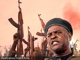
FLASH : Barbecue warns the population of the imminent start of a major counter-offensive by «Viv Ansanm» (video)
Haiti is bracing for a potentially violent confrontation as Jimmy Chérizier, known by his alias ‘Barbecue,’ the leader of the ‘Viv Ansanm’ terrorist coalition, has issued a stark warning to the public. In a video message, Chérizier urged citizens to remain indoors starting Monday, November 17, 2025, as his group prepares to launch a major counter-offensive against law enforcement in the streets of Port-au-Prince. He emphasized the need to avoid civilian casualties, stating, ‘Leave the streets to ‘Viv Ansanm’ and the police so that we can confront them.’ The Haitian National Police (PNH) has taken the threat seriously, suspending all leave and vacations since November 16 and maintaining a high state of alert. The French Embassy in Haiti has also announced its closure on November 17 as a precautionary measure. This development follows a recent large-scale joint operation by the PNH, the Armed Forces of Haiti (FAD’H), and the Gang Suppression Force (GSF) against the ‘400 Mawozo’ gang, which has long held the communes of Tabarre and Croix-des-Bouquets hostage. Chérizier’s message underscores the escalating tensions in Haiti, as the country grapples with widespread gang violence and instability.
-
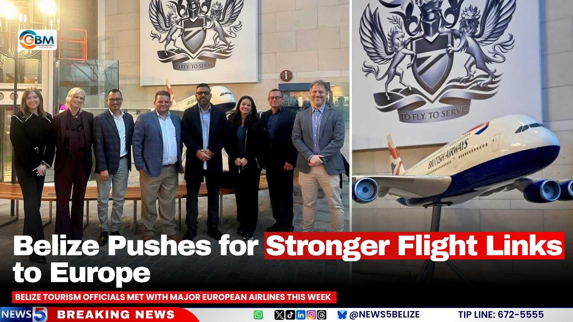
Belize Pushes for Stronger Flight Links to Europe
In a strategic move to revitalize its tourism sector, Belize has initiated high-level discussions with leading European airlines to enhance flight connectivity. The meetings, held this week, focused on key markets such as the UK, Germany, and France, and aimed to address evolving travel trends and the increasing interest of European tourists in Belize. The Belizean delegation, led by Tourism Minister Anthony Mahler, included CEO Nicole Usher and BTIA President Efren Perez. They emphasized the importance of strengthening partnerships with international travel companies and maintaining Belize’s visibility through targeted marketing and media campaigns. These efforts come at a critical time for Belize’s tourism industry, which has faced recent challenges, including an 8.6% decline in overnight tourist arrivals in September and disruptions caused by mass flight cancellations in U.S. airports due to air traffic control shortages and a federal government shutdown. Despite these setbacks, Perez remains optimistic, highlighting Belize’s proactive approach in promoting its tourism offerings and urging stakeholders to remain focused and resilient. The initiative underscores Belize’s commitment to leveraging international collaborations to drive tourism growth and economic recovery.
-
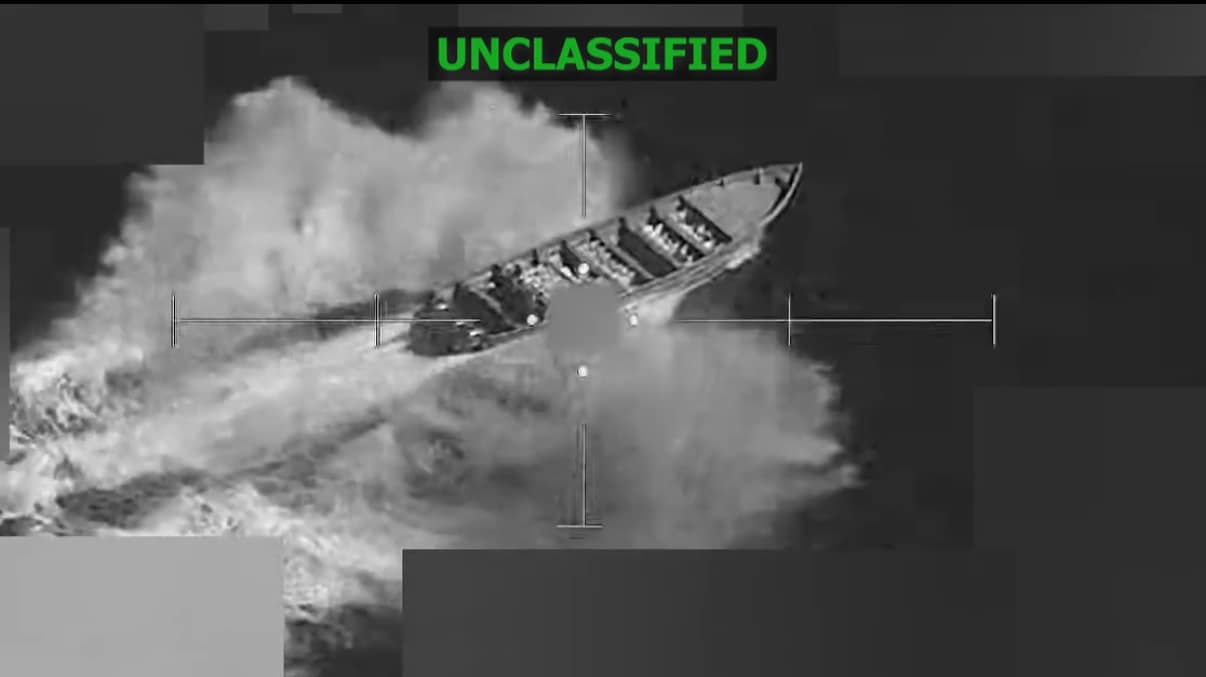
U.S. Strike Kills Three Suspected Narco-Terrorists On Saturday
The United States military has confirmed the execution of a targeted strike on a vessel suspected of narcotics smuggling in the Eastern Pacific, resulting in the deaths of three individuals. The operation, conducted by Joint Task Force Southern Spear on November 15, was authorized by Secretary of War Pete Hegseth, according to a statement released by U.S. Southern Command (SOUTHCOM).
The vessel, reportedly operated by a Designated Terrorist Organization, was intercepted while navigating a known drug-trafficking route in international waters. Intelligence assessments indicated that the craft was transporting narcotics at the time of the strike. The operation led to the elimination of three male individuals identified as narco-terrorists aboard the vessel.
SOUTHCOM emphasized that this interdiction is part of broader, ongoing efforts to dismantle transnational criminal networks active in the region. The strike underscores the U.S. military’s commitment to combating illicit activities that threaten regional security and stability. This operation highlights the strategic use of military force to disrupt organized crime and narco-terrorism in international waters.