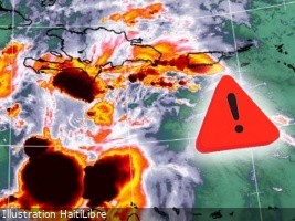
The National Oceanic and Atmospheric Administration (NOAA) has issued a critical update on Tropical Storm Melissa, warning that it is likely to escalate into a hurricane by the end of this week or early next week. As of October 23, 2025, at 5:00 a.m. Eastern Daylight Time, Melissa remains stationary over the central Caribbean Sea, posing a significant threat to Haiti and neighboring regions. The storm’s slow movement, at approximately 6 km/h, increases the risk of prolonged strong winds, particularly affecting the Tiburon Peninsula in Haiti. Authorities have urged residents to expedite preparations to safeguard lives and property, as severe weather conditions are expected to intensify starting Friday. The storm’s center is currently located at 15.0 degrees North latitude and 74.9 degrees West longitude, about 485 km southwest of Port-au-Prince. Melissa is projected to bring heavy rainfall, ranging from 12 to 25 cm, across Haiti, the Dominican Republic, and Jamaica, potentially triggering life-threatening flash floods and landslides. Maximum sustained winds are currently near 85 km/h, with higher gusts, and further strengthening is anticipated by the weekend. A Hurricane Watch has been issued for Haiti’s southwest peninsula, from the Dominican Republic border to Port-au-Prince. The Haitian Maritime and Navigation Service (SEMANAH) has suspended all cabotage activities in the southern coastal area until further notice. The Hydrometeorological Unit, in collaboration with the General Directorate of Civil Protection, has placed five departments—South, Southeast, Grand’Anse, Nippes, and West—under an Orange Alert. Residents are advised to remain vigilant, avoid crossing waterways, and follow safety guidelines issued by civil protection authorities.