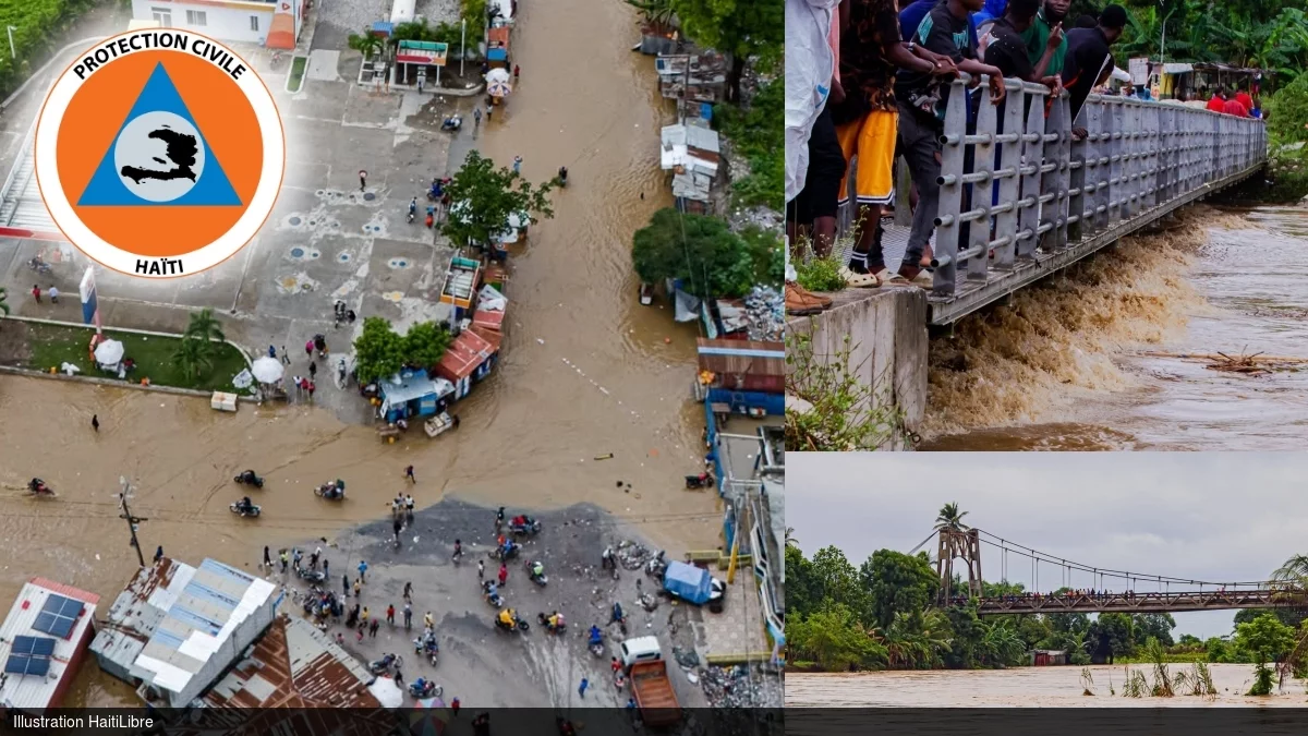
A slow-moving, moisture-saturated unstable air mass that has lingered across the Greater Antilles region, spanning from northern Haiti to the central-western Caribbean Sea, unleashed relentless heavy rainfall across Haiti for three consecutive days through Saturday, October 24, 2026, leaving a trail of fatalities, destroyed infrastructure, and displaced communities across 21 of the country’s communes. According to an official preliminary situation statement released by Haiti’s General Directorate of Civil Protection (DGPC) on October 26, 2026, the provisional confirmed death toll has reached at least 4 people, with one fatality recorded in the South Department, two in Nippes, and one in Grand’Anse, where local officials also report two fishermen are still unaccounted for and presumed missing. The nationwide humanitarian impact extends to 3,209 households that have been directly impacted by the disaster. Infrastructure damage assessments from the DGPC detail that 2,130 residential properties have been fully inundated by floodwaters, with Nippes bearing the brunt of residential flooding at 1,285 flooded homes, followed by 372 in Grand’Anse, 300 in the South Department, and 173 in the West Department. An additional 847 homes have been completely destroyed, while 219 more have sustained partial structural damage that renders many uninhabitable. Hydrological monitoring data confirms 8 rivers have breached their banks across the Nippes Department, and 4 more overflow points have been documented in the South Department. Severe localized flood events have submerged the entire town center of Baradères, the community center in Corail, and a public school in Fond’Icaques, while the critical embankment of the Ravine du Sud suffered a total structural collapse during the peak of the downpours. The disaster has also severed key transportation and communication links across affected zones: the main roadway connecting Jérémie and Chambellan is completely impassable at the Laferme segment, where an adjacent ravine overflowed and washed out large sections of the road surface, while cellular and radio connectivity remains sporadic and unreliable in many remote communes. Haiti’s agricultural sector, which supports the livelihoods of a large share of the national population, has suffered substantial uncounted losses, as fast-rising overflowing rivers swept away entire crop plantations across flood-prone lowland areas. In the town of Corail, municipal emergency teams are currently conducting urgent cleanup operations at the local public hospital, which was partially flooded during the storm, to restore critical medical services for injured and displaced residents. In response to the ongoing hazard, Haiti’s Hydro-Meteorological Unit (UHM), working in close coordination with the DGPC and the National System for Disaster Risk Management (SPGRD), has upgraded national emergency alert levels: the Grand’Anse, Sud, Nippes, Sud-Est, and Ouest departments are now under a high-risk orange alert, while the Artibonite and Nord-Ouest departments have been placed under a lower but significant yellow alert, warning residents in vulnerable hilly and low-lying zones of continued imminent flooding and landslide risks. The DGPC has confirmed that all its central and regional emergency response teams have been fully mobilized, and authorities are in the process of phasing the opening of temporary emergency shelters to accommodate displaced families. The agency has also issued a formal public advisory recommending local authorities consider temporary school closures and the cancellation of all large public gatherings to reduce accident risks, with a full updated follow-up situation report scheduled for release within 24 hours of the October 26 preliminary update.