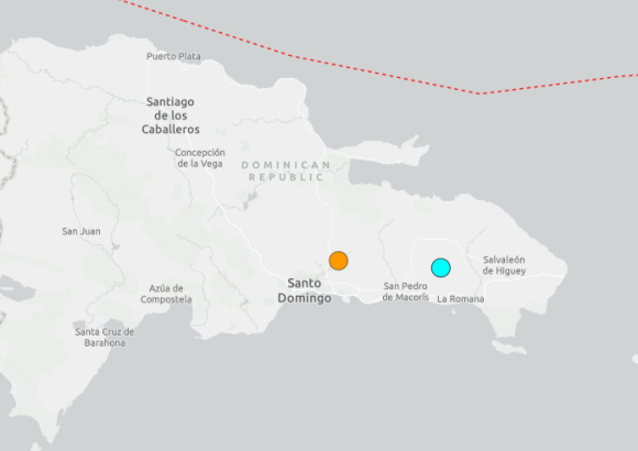
On Sunday, September 27, the Dominican Republic was hit by a sequence of seismic events, with the strongest tremor recorded in the eastern portion of the Caribbean nation, according to compiled data from global and local geological monitoring agencies.
The first notable tremor was captured by the U.S. Geological Survey (USGS) at roughly 6:06 a.m. local time, with its epicenter positioned just 13 kilometers (8 miles) south-southwest of Bayaguana, a town in the province of Monte Plata. The USGS registered this event as a magnitude 4.2 earthquake.
Nearly simultaneous to that measurement, the National Seismology Center of the Autonomous University of Santo Domingo (UASD) recorded a separate magnitude 4.3 quake near San Antonio de Guerra, located in the country’s central Santo Domingo province. This tremor originated at a depth of approximately 95.7 kilometers, and shaking was reported across multiple districts of Greater Santo Domingo.
Residents and local officials confirmed the tremors were felt across a wide swathe of the country, extending beyond the capital region to neighboring provinces including Monte Plata, San Cristóbal, San Pedro de Macorís, Hato Mayor, Sánchez Ramírez, Monseñor Nouel and El Seibo. At the time of initial on-the-ground checks, emergency management teams had not received any reports of fatalities, injuries, or major structural damage linked to the morning’s seismic activity.
Later in the same day, a stronger, third earthquake was detected in the eastern region of the country. Global geological monitoring site Volcanodiscovery, processing raw seismic data, logged a magnitude 5.2 tremor at around 5:49 p.m. local Dominican Republic time, centered just 8 kilometers southeast of Ramón Santana in the San Pedro de Macorís area.
As of the most recent update compiled for this report, there are still no confirmed reports of significant structural destruction or human casualties linked to any of Sunday’s three recorded earthquakes.
Geographically, the Dominican Republic sits within one of the most seismically active zones in the Caribbean, where the interaction of multiple tectonic plates and underlying geological structures creates regular earthquake activity. Local and international seismological authorities maintain continuous monitoring of the region, updating magnitude and location measurements as new data is collected and processed.