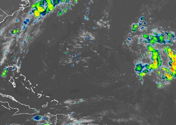
On Sunday, August 23, 2026, the Dominican Institute of Meteorology (Indomet) released a comprehensive daily weather forecast for the Dominican Republic, outlining shifting conditions across the day alongside long-term monitoring of tropical system development in the Atlantic basin. Forecasters attributed the day’s unsettled precipitation pattern to two key atmospheric drivers: the slow approach of a tropical wave and the persistent influence of an upper-level trough.
Through the early morning hours, the agency projected weak to moderate scattered rainfall across multiple northeastern and southeastern regions, including the heavily populated Greater Santo Domingo area as well as Samaná, María Trinidad Sánchez, Duarte, Sánchez Ramírez, La Romana, San Pedro de Macorís, and La Altagracia. Conditions are expected to shift by the afternoon, when isolated heavy downpours will develop across northwestern and southwestern provinces, including Monte Plata, Santiago Rodríguez, Dajabón, Elías Piña, and the northern half of San Juan. Forecasters warn these intense afternoon storms will likely bring thunder and lightning, with possible sudden gusty wind that could create localized hazards.
In addition to precipitation, Indomet noted that a thin veil of Saharan dust will continue to linger over the entire country, creating a hazy, gray, opaque sky through much of the day. Compounding this atmospheric condition is a persistent heat warning: the institute emphasized that high temperatures will remain in place, with elevated thermal sensation that poses health risks to vulnerable populations. To mitigate heat-related illness, officials have urged all residents to drink water regularly, wear loose-fitting, light-colored lightweight clothing, and avoid unprotected extended exposure to direct sunlight. They specifically reminded the public that children, pregnant people, and older adults face heightened vulnerability to heat complications.
Beyond daily forecasts, Indomet is actively monitoring tropical cyclone development across the Atlantic. Forecasters project that a new tropical wave will exit the west coast of Africa early next week, with the system expected to organize into a low-pressure area shortly after emerging over open water. Over the next seven days, the system has a 50% chance of strengthening to tropical cyclone status. Due to its potential long-term trajectory, Indomet has stressed the importance of continuous monitoring to track any changes in the system’s path and intensity.
Forecasters are also tracking two other disorganized areas of storm activity in the Atlantic, though both pose no immediate threat to the Dominican Republic. The first system is positioned northeast of the Azores Islands, holding just a 10% chance of cyclonic development over the next 48 hours. The second, located east of Bermuda, has a slightly higher 20% chance of organization over the same period. Neither is projected to track toward Caribbean waters in the coming days.
Indomet has urged the Dominican public to stay updated on changing weather conditions by accessing official forecasts through its official web portal, www.indomet.gob.do, and its social media channels @indometrd.