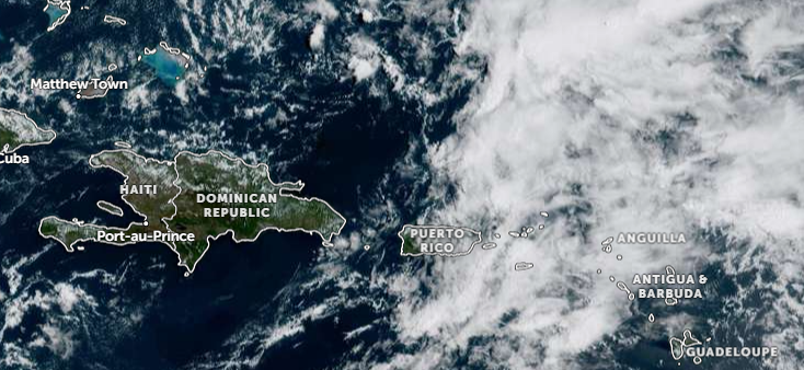
Residents across the Dominican Republic are preparing for another day of disrupted weather on Tuesday, as the Dominican Institute of Meteorology confirms ongoing unstable conditions driven by a low-pressure trough penetrating multiple layers of the troposphere. The atmospheric system has locked the nation in a pattern of persistent rainfall that is expected to hold throughout the day, bringing varied hazards across different regions.
Early morning brings the first round of precipitation, with scattered showers forecast to sweep across the country’s northern and northeastern provinces. Popular tourist and population hubs including Puerto Plata, Santiago, and Samaná will see this initial wave of rain, which the meteorological service projects will ease temporarily midday before gaining strength once again as afternoon sets in.
Meteorologists explain that the combination of accumulated daytime heat and the underlying atmospheric instability will create ideal conditions for intense precipitation development. From mid-afternoon through early evening, moderate to heavy downpours, rolling thunderstorms, and sudden strong wind gusts are most likely to impact Greater Santo Domingo, as well as central, eastern, and southwestern sections of the country.
Hazard outlooks extend beyond heavy rain for higher elevation zones: the national weather agency has issued a special warning that isolated hail events are possible across mountainous areas, paired with localized severe wind bursts that could bring down tree branches or disrupt utility service. As a result of the multi-day rainfall risk, a large swath of the country remains under active weather alerts, with officials flagging dangers including sudden urban flash flooding, overflowing rivers and streams, rain-triggered landslides, and dangerous electrical activity from thunderstorms.
Temperatures will remain unseasonably hot in the hours before rain arrives, pushing heat indexes into potentially dangerous ranges for outdoor activity. In response, health and weather officials are urging the public to prioritize consistent hydration and stay in well-ventilated spaces to avoid heat-related illness ahead of the afternoon downpours.
Marine hazards are also in effect for one stretch of the country’s coastline: along the Dominican Republic’s Atlantic shore, running from Cabo San Rafael to Punta de Manzanillo, small and medium-sized recreational and commercial vessels have been urged to avoid non-essential travel and navigate with extreme caution due to elevated rough sea conditions. By contrast, marine conditions along the country’s southern Caribbean coast remain within normal ranges, with no special advisories in place for that area.
Authorities closed their update by reminding the public that weather conditions can shift rapidly amid this unstable pattern, and that residents should closely monitor official weather updates from the Dominican Institute of Meteorology, and follow all published public safety guidelines to avoid preventable risk during the weather event.