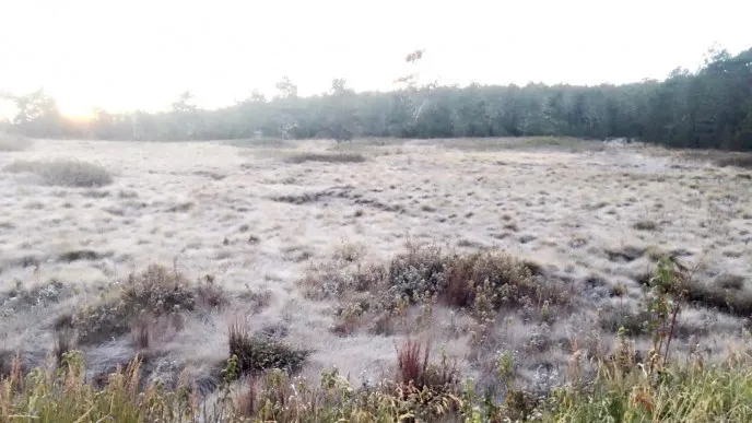
The Dominican Republic’s elevated regions are experiencing an extraordinary meteorological event as a severe cold spell grips the mountainous zone of Constanza. For two consecutive days, the Las Pirámides sector within Valle Nuevo has recorded sub-zero temperatures, marking the beginning of what forecasters predict could be an extended period of exceptionally cold conditions potentially lasting through mid-2026.
Meteorological expert Jean Suriel documented the dramatic temperature plunge, with readings dropping to 0.2°C on Monday followed by a concerning descent to -0.5°C in Tuesday’s early hours. The situation was further exacerbated by wind chill factors driving the perceived temperature down to approximately -2°C. These extreme conditions have triggered two distinct cryospheric phenomena: the freezing of moisture on vegetation creating widespread frost, and the formation of hoarfrost from frozen fog—a rare occurrence typically reserved for high-altitude environments with severe cold exposure.
The meteorological explanation points to a convergence of two significant weather systems. The unusual cold pattern originates from the advancement of frontal system number 14 across the northern Caribbean basin, which has merged with an invading polar air mass. This combination is being propelled by cold Atlantic winds that are channeling Arctic air deep into the Caribbean nation. The geographical configuration of the Dominican Republic’s highland areas, particularly those exceeding 2,000 meters in elevation, makes them exceptionally vulnerable to these intensified cold air incursions, creating microclimates that mirror temperate zone winter conditions rather than typical Caribbean weather patterns.
