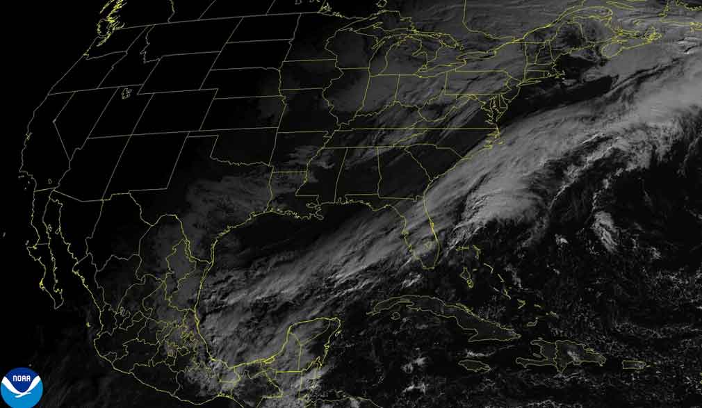
Meteorological authorities in Cuba have issued a detailed forecast indicating a significant shift in weather patterns for the nation’s western region. The Institute of Meteorology (Insmet) reports that residents in the provinces of Pinar del Rio, Mayabeque, and the capital city of Havana should prepare for increasing cloud cover commencing in the late afternoon hours. This cloud development is expected to precipitate into showers and sustained rainfall, with meteorological models projecting an intensification of these conditions as evening approaches.
The deteriorating weather system will bring multiple consequential effects across western Cuba. A notable increase in wind velocity is anticipated to commence tomorrow, adding another element to the unsettled conditions. Furthermore, a continued downward trend in maximum temperatures is forecasted, with the most significant drop expected by Friday, marking a distinct shift from recent conditions.
Temperature parameters have been specifically outlined by Insmet meteorologists. Maximum daytime temperatures across affected regions will range between 28°C and 31°C (82°F and 88°F), with inland areas experiencing the warmer readings. Overnight minimums will provide some relief, settling between 21°C and 24°C (70°F and 75°F).
Wind patterns will undergo a distinct evolution throughout the forecast period. Initial light and variable winds are predicted to shift, becoming consistently northeasterly along Cuba’s northern coastline. Wind speeds are expected to range between 10 to 25 kilometers per hour, with notably stronger gusts projected for the northwestern coastal areas. Marine conditions will reflect this atmospheric activity, with swells developing along both eastern coastlines. The northwestern coast will experience a gradual increase in swell activity beginning in the afternoon, while the remainder of the Cuban coast will see only slight swells, according to the comprehensive Insmet analysis.